Everyone talks about the fabulous beaches of Sydney – and rightly so. But who talks about the amazing forests one can find in the city? I will!
Because here’s the thing: when you talk about a city with over 5 million inhabitants, you don’t immediately think about green spaces, let alone forests. Or the adventurous walking tracks that took us through Cabbage palm groves or rainforests, or along rushing creeks – all inside Sydney, or very close to the city, yet feeling so remote.
That’s what I like about Sydney so much: nature. The harbor and the small bays, the beaches and headlands, and also the gullies and forests. I’ve already written about the beaches and my favorite coastal walks, so now let’s talk about the best forest walks in Sydney.
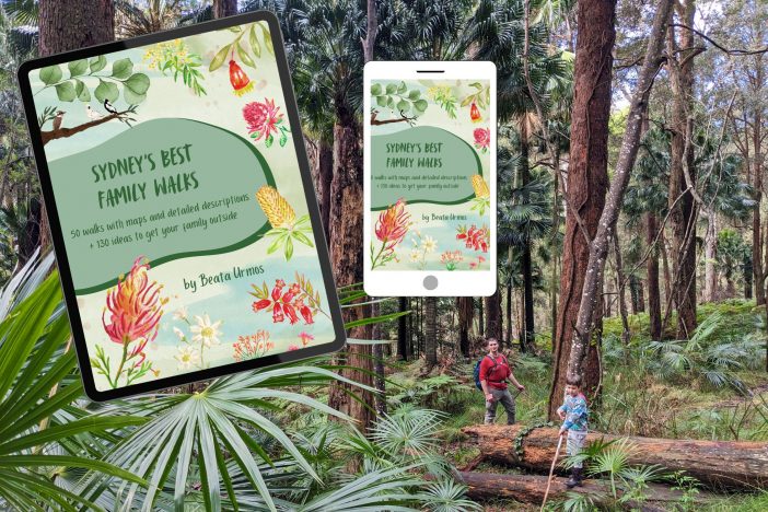
Want amazing Sydney family walks without the planning headache?
My ebook features 50 detailed, kid-approved trails with maps, parking, pram info & fun “Play Factor” highlights. PLUS: 130+ nature play ideas & printables to get your family outdoors!
Spend less time searching, more time exploring. Get your instant download!
A gentle note: I won’t include any of the Blue Mountains bushwalks in this post, because they would fill an entire article on their own. Well, I’ve written about some of my favorite Blue Mountains walks already – check them out here.
My 10 favorite forest walks in Sydney
Forest Path, Royal National Park
It has a simple name, and it’s an easy rainforest loop walk, yet it impressed us from the very first steps on Lady Carrington Drive.
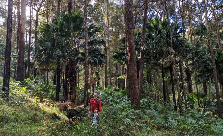
Royal National Park is famous for its amazing coastal views, but this rainforest offers a different kind of amazement: jungle vibes, huge Cabbage tree palms, hanging vines, lush ferns and giant leaves that meet in the middle across the walking track. I was in awe. I couldn’t put my camera away – but no picture does justice to the beauty of this forest. And yes, I’m raving about a forest all the while. It deserves it, believe me.
The Forest Path is one of the oldest trails in Royal National Park, located close to Waterfall. And it’s a much better choice for the hotter part of the year than the stunning, but unshaded Royal Coast Track, because the Forest Path is shaded all the way. But we enjoy it on colder, rainier days, too, it adds to the vibe.
The loop trail starts at the junction of Sir Bertram Stevens Drive and Lady Carrington Drive. This latter is a walking track, you can’t actually drive there, but you can leave your car at the junction. Then you can start walking among the tall trees and thousands of ferns on Lady Carrington Drive.
Soon you reach the junction with the Forest Path, and the track gets narrower, less light enters through the dense canopy and this magical rainforest closes in around you. The path remains quite easy and obvious, with the occasional stairs and with the sound of the creek. You’re surrounded by dozens of huge Cabbage tree palms and different species of fern (and other lush jungle plants that I can’t recognize).
If you’d like to include Palona Falls, make it a 8 km return with the detour. The waterfall is small, but lovely, and there’s a huge cave right next to it.
Forest Path hiking info:
- Trailhead: the junction of Sir Bertram Stevens Drive and Lady Carrington Drive
- Length: 4.4 km loop
- Difficulty: easy
- See the Forest Path on a trail map here.
Couranga Track, Royal National Park
This track starts out from the Waterfall train station as quite an average bushwalk, and you hike through dry woodland for a while. Then all of a sudden the track gets steeper and takes you downhill, and you find yourself in a dense and spectacular rainforest, with towering Cabbage tree palms, hanging vines, mossy boulders and a rushing creek.
The walking track is 5 km one-way, and it’s descending for most of the way (if you start at the train station) – which means you’ll walk uphill as you return on the same way. But it takes you down to one of the prettiest rainforests near Sydney! You can even join it with the other one that matches with its beauty: the Forest Path.
Couranga Track hiking info:
- Trailhead: Waterfall train station
- Length: 10 km return
- Difficulty: medium
- See the Couranga Track on a trail map here.
The Karloo Pool & Olympic Pool Track, Royal National Park
I promise that not all of the walks are from the Royal National Park, but it has so many spectacular walks that I need to include a third one in this list. This is especially tempting in the summer since you’ll find many natural swimming holes along the way.
It doesn’t look that spectacular in the beginning, because you’ll start on a fire trail behind the Heathcote train station. The trail gets steeper and the forest is lovely, but the first real highlight is the Karloo Pool. This natural swimming hole is postcard perfect, though a bit busy on hot days – not surprisingly! It’s deep enough and warm enough for a swim, and there’s a small waterfall that feeds the pool. The surroundings are idyllic, too.
You wouldn’t feel like you’d ever want to leave Karloo Pool behind, but I encourage you to carry on, because the best part comes after that. I enjoyed following Kangaroo Creek, and I wasn’t able to decide whether it’s the forest, the creek or the countless tempting swimming holes that impresses me most. It’s a dry forest, with lots of twisted eucalyptus branches and serene water scenes.
The well-maintained part of the trail ends at Olympic Pool, which is one of my favorite swimming holes near Sydney, and we spent the rest of the day here. It’s a wonderful, large swimming hole, with plenty of smooth rock surfaces for sunbathing and not too many visitors. Though visitor numbers are increasing, and it’s definitely not a secret, it’s much quieter than Karloo Pool.
Also, the hike between the two pools is very picturesque, and you can jump into some of the smaller swimming holes on the way, too.
Karloo Pool and Olympic Pool Track hiking info:
- Trailhead: Heathcote train station / Wilson Parade
- Length: 8.2 km return
- Difficulty: medium
- See the Olympic Pool Track on a trail map here.
Koolewong Track, Ku-ring-gai Chase National Park
Ku-ring-gai Chase National Park is just on the northern outskirts of Sydney, but it feels like a remote wilderness, with dense forests and wonderful vistas. The Koolewong Track is one that offers both!
It leads through bright eucalyptus forest and patches of very picturesque cabbage palm groves. Moreover, it ends at a spectacular lookout over Broken Bay, Lion Island and the Central Coast in the distance. What else would you need? Oh, it’s a very short and easy walk, with minimal elevation change, suitable for families and small kids, too.
It’s a great introduction to bushwalking, because there’s uneven terrain and the occasional roots and rocks, so it’s definitely a real hike. It’s also a perfect introduction to Ku-ring-gai Chase National Park, because it showcases all the characteristic beauties of the park.
Once you’re done with the Koolewong Track, drive (or hike) a bit further to the recently renovated West Head lookout. It offers even more wonderful views of Broken Bay and the Barrenjoey Headland from safe lookout platforms, and there are a variety of picnic benches, a lot of them shaded by beautiful trees.
Koolewong Track hiking info:
- Trailhead: Resolute picnic area parking
- Length: 1 km loop
- Difficulty: easy
- See the Koolewong Track on a trail map here.
Find this guide useful? Say thanks with a coffee!
If you find the articles helpful or inspiring for planning your own adventures, please consider showing your appreciation with a small tip – like buying me a virtual coffee!
Every contribution, no matter the size, helps me stay independent and focused on quality content.
Donate now and make a difference—thank you!
The Gibberagong Track, Ku-ring-gai Chase National Park
The Gibberagong Track is in the Bobbin Head area of Ku-ring-gai Chase National Park, and it connects Bobbin Head and Wahroonga. There’s no spectacular viewpoint here that would be similar to the Koolewong lookout, but the gorgeous forest itself is enough as an attraction!
The Gibberagong Track runs along a pretty creek, with orange rocky overhangs and huge mossy boulders, and it made me feel like being transported to tropical Northern Queensland. Even though it seems like “just a forest track”, it’s actually a jungly adventure, and the track is fairly rough at places, with lots of ups and downs, rocks and tree roots. But it leads you through a picturesque wilderness that starts a few meters away from a residential area, yet it feels hundreds of miles away.
The forest is filled with songs of birds and the sound of water, and there’s a turquoise natural water hole suitable for swimming, too. Not far from it there’s another pool on the river bend. And barely anyone comes here – because it’s Australia, full of stunning gems visited by no one.
Gibberagong Track hiking info:
- Trailhead: Bobbin Head picnic area (or Grosvenor Street in Wahroonga)
- Length: 6.3 km one-way
- Difficulty: easy
- See the Gibberagong Track on a trail map here.
Most of the time we pack simple snacks, but for longer hikes we add one or two more filling options — not cheap, not essential, but genuinely helpful on tired legs and long days.
Bluff Lookout & Bantry Bay Track, Garigal National Park
Garigal National Park is among the most underrated ones in the Sydney metropolitan area, and it has particularly lovely bushwalks, with pretty views of the secluded bays of Middle Harbour.
The Bluff Lookout is a short forest walk to a natural rock plateau with an amazing view of Bantry Bay and the distant Sydney skyline. From the lookout continue down to Bantry Bay on the steep forest track. The dry woodland is dotted with sandstone rock formations, but the most special is the view of the mangrove forest as you hike along the bay.
Have a picnic at the pier in the Bantry Bay Reserve before you head back up the same way.
Bantry Bay hiking info:
- Trailhead: at the end of Grattan Crescent in Killarney Heights
- Length: 2.5 km one-way
- Difficulty: medium
- See the Bantry Bay Track on a trail map here.
Two Creeks with the Little Digger Track, Garigal National Park
Here’s another, longer, but very picturesque forest track in Garigal National Park: the combination of Two Creeks Track and Little Digger Track. I love that this 7 km loop feels like walking through pristine wilderness, with grass trees, lush ferns and fabulous views of Middle Harbour Creek and Moores Creek. Until you reach the street again and get back to the starting point through some quiet residential streets.
Lindfield Oval is not the only possible trailhead, but it’s the most straightforward. It’s easy to find, and there’s plenty of parking. There are several walking paths in Lindfield Oval, so look for the signs for “Two Creeks”, it’s right behind the tennis court. Once you’re on the right track, you’ll soon find yourself in the beautiful forest, hearing only distant sounds of cars for a little while, then only the sounds of cockatoos and kookaburras remain.
There are some cool sandstone rock formations as you take the stairs downhill, then you’ll join a fire trail that goes parallel to Gordon Creek (you won’t see the creek, but you’ll hear it). This is not the most exciting part of the track, but it’ll get so much better!
The first glimpses of emerald green Middle Harbour Creek impress, and they stay with you for quite a while. This was my favorite section. It’s one of the quiet ends of the huge Sydney Harbour, and you can get down to the rocks right by the bank. Basking in the sunshine and gazing at the creek from these rocks are the highlight of this hike.
Moreover, you’re surrounded by amazing forests: the lush ferns and twisted eucalyptus trees on one side, then the mangrove forest by the water. Keep your eyes open to see herons and cormorants, plenty of them are on the search for food here any time of the day.
Moores Creek is a very small one, but with stunning mangrove forest. As you leave the small creek, you’ll pass under huge rock overhangs and walk through a small patch of rainforest. I’ll be honest, the waterfalls along Moores Creek (Babbage Falls and Little Falls) are not much, but the forest itself with the tiny creek is lovely.
To make it a loop, you need to walk about 600 meters on the streets to get back to Lindfield Oval.
Two Creeks Track hiking info:
- Trailhead: Lindfield Oval
- Length: 7 km loop
- Difficulty: easy
- See the Two Creeks and Little Digger loop on a trail map here.
The Magazine Track to Flat Rock Beach, Garigal National Park
Here’s one more from Garigal National Park, because it has nothing but amazing bushwalks: the Magazine Track to Flat Rock Beach. It starts as a narrow side path from Cook Street in Roseville, and the very first section is called Bates Creek Track. But you soon reach Magazine Track that will take you to one of the best secret beaches of Sydney Harbour.
You’ll walk through dry forests and among huge grass trees, and also through cooler areas where lace ferns are abundant and you hop over a small creek. You’ll look over mangrove swamps and fabulous Bantry Bay. Finally, you’ll get down to Flat Rock Beach, a tiny patch of sand that only exists at low tide, but if you visit it at the right time, it’ll be your naturally shaded, tranquil family-friendly beach, with shallow water and gentle waves.
There’s one small drawback: a section of the track runs right next to a fence (the remnants of the abandoned Bantry Bay explosives depot) and further from the water, and this section is a bit boring. But the rest is pure delight, so I still think it deserves to be on the list of the best forest walks of Sydney.
Magazine Track hiking info:
- Trailhead: Cook Street in Roseville
- Length: 3.2 km one-way
- Difficulty: easy
- See the Magazine Track on a trail map here.
Blue Gum Forest, Hornsby
Living in Hornsby, this is not only one of our favorite local walks, but it’s among the most spectacular forest walks we’ve ever found in Sydney. Yet it’s quiet and it feels remote. (Welcome to Australia, home to countless stunning, quiet natural gems.) This is where I go if I quickly need a dose of unspoilt nature on a random day, and this is where I take my son for a soothing walk after school.
The Blue Gum Forest walk is picturesque from beginning to end. You walk among majestic Blue Gum trees, through the valley of ferns, under large rock overhangs and along rushing Berowra Creek.
You can start the track either from Hornsby Park (at the end of Rosemead Road) or Ginger Meggs Park. You’ll get into the dense forest right away.
If you start from Hornsby Park, you’ll soon reach the Fishponds, which is a lovely lookout over Berowra Creek. From this point you’ll follow the creek, then cross it and ascend back through lush ferns and pretty forest. What else could I say? It’s pretty, pretty forest and a patch of tranquil nature on the outskirts of Sydney.
Blue Gum Forest hiking info:
- Trailhead: Hornsby Park or Ginger Meggs Park
- Length: 4.2 km loop
- Difficulty: medium
- See the Blue Gum Forest walk on a trail map here.
Dog Pound Creek Conservation Reserve, Westleigh
This is such an easy walk right off the street, connecting Hornsby and Westleigh! Yet it delivers an atmosphere of being in the midst of a remote, lush rainforest, with huge ferns and a pretty, cascading waterfall (that you can only properly see if you go off track).
You can start at either end, and then walk back the same way. Whichever you choose you’ll start with stairs that take you down, either at the end of Valley Road in Hornsby or from Warrigal Drive in Westleigh. We normally walk from Hornsby, so that’s what I’ll describe.
So at the bottom of the wooden staircase, you cross Waitara Creek on stepping logs. Then a wide fire trail takes you further into the forest. You need to watch out for Wirrega Falls, because you’ll hear it, but if you also want to see it, a short detour is required on a narrow, steep and definitely unofficial path. I guess it doesn’t have much water during dry spells, but when we visited after a period of heavy rains, it looked fabulous and sounded roaring!
Then you’ll cross Larool Creek, too, and that’s when you find yourself in the most beautiful area of the forest (and this area is called Dog Pound Creek Conservation Reserve). The forest gets dense, you see lush ferns everywhere and you can look up to tall eucalyptus trees. It’s like a piece of the jungle, tossed among the streets of Hornsby and Westleigh. If you reach the end, just turn back.
This is again one of my favorite walks for any part of the day in any kind of weather when my soul craves to be in the wild and to look at trees and greenery.
Dog Pound Creek Conservation Reserve hiking info:
- Trailhead: at the end of Valley Road in Hornsby or from Warrigal Drive in Westleigh
- Length: 1.1 km one-way
- Difficulty: easy
- See the Dog Pound Creek Conservation Reserve walking track on a trail map here.
More fabulous forest walks near Sydney
The reason I haven’t included the Blue Mountains here is partly because you need to drive 1-2 hours from Sydney to reach the bushwalks in the Blue Mountains, and there are so many that they deserve their own post.
You can also drive north on the Pacific Coast Highway to the Central Coast. While you might picture beaches at first, the Central Coast is home to amazing bushwalks, too.
If you drive southwards, Morton National Park is among the best ones in all of New South Wales, with impressive waterfalls and gorges, like Fitzroy Falls and Belmore Falls, but also with picturesque forests, gullies and rainforest walks.
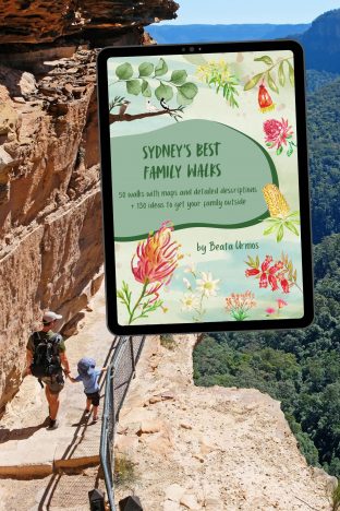
Tired of endless searching for kid-friendly Sydney walks?
Stop the guesswork! My Sydney’s Best Family Walks ebook gives you 50 kid-tested trails with all the details you need: maps, parking, difficulty, pram access, and unique “Play Factor” notes. Plus, get 130+ bonus nature play ideas & printables!
Unlock stress-free family adventures.
What to pack for NSW hikes? (What actually helps)
You don’t need fancy gear for most NSW walks, but a few well‑chosen basics make a big difference — especially once tracks get wet, weather changes quickly, or the walk ends up being longer than planned.
Comfortable walking shoes
Good grip matters more than brand names here. Wet tracks, slippery rock crossings and muddy rainforest paths are common. The Columbia Newton Ridge waterproof hiking boots (both women’s and men’s versions) are supportive, grippy, and comfortable straight out of the box, which is always a win.
Rain protection (two useful options)
- For sudden downpours or short walks, a lightweight rain poncho (like the Frogg Toggs Ultra‑Lite style) is brilliant — packs tiny, goes on fast, and keeps both you and your backpack dry.
- For windy coastal walks or longer hikes, a proper rain jacket is more comfortable. Lightweight options like the Columbia Arcadia (women) or Glennaker (men) jackets work well without feeling bulky.
Sun protection
Yes, even in the forest. A wide-brim hat and sunscreen are still essential, especially on exposed lookouts, gorge rims and coastal sections.
Reusable water bottles
Bring more water than you think you’ll need, especially in summer. A stainless steel (metal) bottle is a solid choice — no microplastics, keeps water cooler for longer, and survives being knocked around in a backpack. We like insulated metal bottles for longer days.
Snacks
For short walks, simple snacks, like energy bars, are fine. For longer hikes, we’ve learned to add one or two more filling options — not cheap and not something we bring every time, but genuinely helpful when energy dips and legs start to complain.
Small first‑aid kit
Nothing fancy — just enough for blisters, scrapes and the usual trail mishaps. It’s one of those things you hope not to use, but you’re very glad to have when needed. You can buy a pre-made kit or make one for yourself.
Swimmers and a quick‑dry towel
Rock pools and waterfalls have a way of changing plans. A compact, quick‑dry towel takes up very little space and earns its place surprisingly often.
Insect repellent
Especially after rain, and especially in rainforest sections. Mozzies are simply part of the ecosystem, along with leeches. Repellent makes them much more tolerable. If you don’t like spray, use patches. Bands are practical for multi-day hikes and longer camping trips.
Offline maps or downloaded trails
Phone reception is unreliable once you leave towns. Download maps or trails in advance so you’re not standing at a trailhead staring at a loading screen.
Travelling with kids?
A child carrier is far more practical than a pram on rainforest tracks, and throwing in a spare layer is rarely a mistake — someone will get wet, cold, or both.


Leave a Reply