Ku-ring-gai Chase National Park is not the best known, and I’m not sure why. It offers scenic views and a wide network of walking tracks. It’s home to winding creeks and significant Aboriginal sites, eucalypts and mangroves, rocky cliffs and golden sand beaches, and it’s the best place to bump into shy wallabies in the wild. All without leaving the Sydney metropolitan area.
It’s Australia’s second-oldest national park, and one of the closest to our home. We often go there for solitude and beauty, and we rarely even meet other people, especially on a weekday. We’ve walked most of the trails in the park and put together this list of the best walks in Ku-ring-gai Chase National Park in the end.


Best short Ku-ring-gai Chase National Park walks
Since we live so close to Ku-ring-gai Chase National Park, it’s often the park I choose for short hikes by default. And it offers a wide range of short hikes which are easy to fit into a lovely afternoon or do as an introductory hike with small kids. If you visit on a weekday, you’ll likely be alone on any of the tracks, and it never gets very busy even on the weekends. Sydney has too many scenic walks, that’s my only explanation for this, because Ku-ring-gai offers spectacular lookouts and even a few wonderful beaches.
These short hikes are all under 5 km there and back.
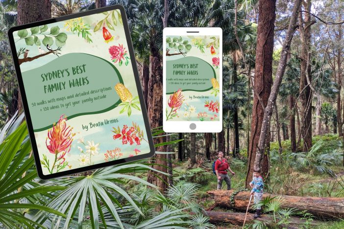
Want amazing Sydney family walks without the planning headache?
My ebook features 50 detailed, kid-approved trails with maps, parking, pram info & fun “Play Factor” highlights. PLUS: 130+ nature play ideas & printables to get your family outdoors!
Spend less time searching, more time exploring. Get your instant download!
America Bay Track, West Head area


rain and shine at the lookout
America Bay Track is one of the first bushwalks I completed with toddler Tomi after we moved to Sydney. It’s short (only 1 km one-way), has little elevation change (you’re descending on the way there and ascending on the way back), offers several water access points (and even more if I count the puddles after rain) and a picturesque lookout over America Bay.
It doesn’t take you down to America Bay (it would mean much more elevation change), the water is represented by a merry stream that you cross just before reaching the lookout, and the tiny cascading waterfalls right by the lookout. The lookout is a large, smooth rocky plateau where you can comfortably sit (and share some snacks with your little one, or your husband).
Really, there’s not much else to say about this track, it’s short and sweet, a great introductory hike to Ku-ring-gai Chase.
America Bay Track hiking information:
- Trailhead: America Bay Track pullout
- Length: 1 km one-way
- Difficulty: easy
- See the route on a map here.
Koolewong Track, West Head area
Koolewong Track is another very easy loop that’s a delight from the first step to the last. The track leads through bright eucalyptus forest, patches of very picturesque cabbage palm groves, and it ends at a spectacular lookout over Broken Bay, Lion Island and the Central Coast in the distance.

It has little elevation change, but it’s a true hike, with uneven terrain and the occasional roots and rocks. It’s a perfect track to practice hiking with kids, and it’s a short, delightful walk to take your visitors if you want to show them the characteristic beauties of Ku-ring-gai.


West Head Lookout
Once you’re done with Koolewong Track, drive to the recently renovated West Head lookout. It offers even more wonderful views from safe lookouts and a variety of picnic benches, most of them shaded by trees.
Koolewong Track hiking information:
- Trailhead: Resolute picnic area parking
- Length: 1 km loop
- Difficulty: easy
- See the route on a map here.
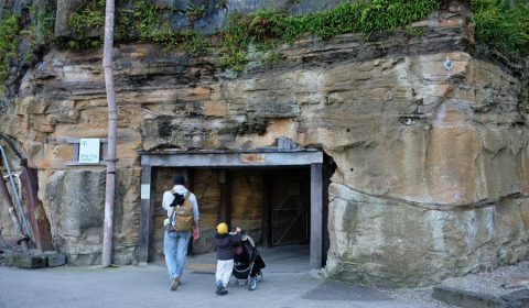
Topham Track, West Head area


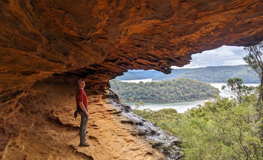
It’s yet another easy forest walk that takes you to two separate viewing areas at the end. The natural rock platforms look over Refuge Bay and America Bay. If you feel a bit more adventurous, climb down under the left lookout on a narrow pathway which leads into a cool natural cave shelter.
The track itself is mostly a wide fire road without much shade, which means the best time to do this hike is the cooler months when you crave to feel the warmth of sunshine. The last section that leads out to the rocky plateaus can be a bit more tricky, because the track gets narrower, and several tracks exist, but it’s a very short section, and they all lead to either of the lookouts.

Topham Track hiking information:
- Trailhead: Topham Track pullout along West Head Road
- Length: 2.2 km one-way
- Difficulty: easy
- See the route on a map here.
Lovetts Pools, Elvina Waterfall & secret lookout, West Head area
We’re almost guaranteed to be alone on the Elvina Track on any day. And what if you leave the main track and take a narrow pathway into the bush? That’s where you’ll be most impressed: by a lovely waterfall and rock pool and a very scenic secret lookout.

But how exactly to find them? Park at the Elvina Track, which has a small, paved parking lot, and set off on the wide fire road. Keep your eyes open for a side track to the left, that’s your way to the waterfall and the lookout. It’s a bit overgrown at places, but quite obvious all the way. It takes you directly to the small stream, and you’ll be at the top of Elvina Waterfall. Follow the track that takes you down to the bottom of the falls where there’s also a shallow rock pool, the Lovetts Pools (more suitable for kids to splash than for actual swimming) and a smooth rock platform, ideal for lying down or sitting.
If there was enough rain before your visit, there will be a second waterfall just below Lovetts Pools. It runs dry for most of the year, but you can get down to it, because depending on the water level it might be easier to cross the small stream there. Wet rocks can be extremely slippery, but you need to cross the stream to reach the lookout.

The lookout sits at the top of a natural rock plateau, so search for a pathway that goes steeply uphill after crossing the stream. There might be several pathways, and I doubt any of them are official trails, but don’t let that stop you, because the lookout is worth searching for. If you follow any of the beaten tracks they lead you to the plateau from the back. There’s a glen where you can climb up. This is the most technical part of the hike, but it’s nothing too challenging. I completed this hike several times with my son from as early as 3 years old.
Once you’re up on the rock plateau, just follow the path in the bush. It’s an easy walk to the very edge of the plateau. The cliffs are large enough so that you can stay well away from the edge, but still enjoy a fantastic view over Lovett Bay, the Pittwater and the Northern Beaches.

The bushwalk is particularly lovely at the end of winter and in spring when thousands of wildflowers are blooming.
Elvina Waterfall hiking information:
- Trailhead: Elvina Track along West Head Road
- Length: 1.8 km one-way
- Difficulty: easy (moderate from the waterfall to the lookout)
- See the route on a map here.
Find this guide useful? Say thanks with a coffee!
If you find the articles helpful or inspiring for planning your own adventures, please consider showing your appreciation with a small tip – like buying me a virtual coffee!
Every contribution, no matter the size, helps me stay independent and focused on quality content.
Donate now and make a difference—thank you!
Flint and Steel Beach Track, West Head area

Flint and Steel Beach is one of our favorite wild beaches in Sydney. Its protected enough to be safe for swimming, there’s lush green eucalyptus forest to back up the pretty patch of sand, there are cool rock pools to observe at low tide at both ends of the beach, and you’re likely to meet resident wallabies behind the beach or anywhere along the track.
But you have to walk about 1 km to reach this beach, and the walk is a steep downhill, with lots of stairs. Because of the short distance, it’s not really difficult, but it’s something to keep in mind when you prepare: wear good walking shoes and expect to carry toddlers on the way up. Also, expect to carry all your stuff up at the end of the beach day.


Unfortunately, there’s no toilet at the beach, and you need to carry drinking water and food. But the lack of facilities also means that you truly feel in the wilderness, even though it’s in Sydney and easily reachable.
Flint and Steel Beach Track hiking information:
- Trailhead: Flint and Steel Beach parking along West Head Road
- Length: 1 km one-way
- Difficulty: moderate
- See the route on a map here.
Best longer walks in Ku-ring-gai Chase National Park
If you’re that kind of a hiker who laughs when someone calls a track under 5 km a hike, or you simply want a longer adventure into the Australian wilderness, this section is for you. None of these trails are particularly long or demanding, especially if you’re used to hiking in the mountains, by the way. But they include some slippery or overgrown sections, a nice workout and even nicer views.
I know there’s more longer walking tracks in Ku-ring-gai Chase National Park, but this is the summary of my favorites:
Towlers Bay Circuit, West Head area

Birnie Lookouts is one of the most amazing and most peaceful lookouts in Ku-ring-gai Chase National Park. And the steep downhill path to Lovett Bay leads through one of the most picturesque palm forests in Metropolitan Sydney. These two things make Towlers Bay Circuit a favorite.
I admit that there’s a few kilometers of not so exciting walk on the wide, shadeless fire road until you reach the circular section. I admit that some sections of the loop are extremely muddy even during dry spells, and that you definitely need a map, because it’s easy to lose the track at places. But it’s all worth it.
You start the track along West Head Road, like so many others, and Towlers Bay is signposted at the parking lot. That boring fire road is hard to miss, but then you need to keep your eyes open for the side path that leads to Birnie Lookout. Actually, keep your eyes on the map, because you really need to look for the path to notice it – though someone built a small signage from rocks.

But it’s an obvious path once you’re on it, though a bit overgrown at places. It leads you out to the edge of a rocky platform: Birnie Lookout. There’s an old bench, or you can simply sit on the smoother rocks and enjoy the mesmerizing view of Lovett Bay, Elvina Bay and Scotland Island.
From the lookout you’ll start descending to Lovett Bay, and it’s quite a steep, narrow, zigzagging track. With the huge cabbage palm around you it feels quite like a jungle adventure. As you reach the water level, you get glimpses of the mangrove forest, then you arrive at the small settlement. Here the path gets quite confusing, and sometimes I felt like we walked through people’s backyards (we might have, and in that case, my apologies), but I stubbornly kept my eyes on the map, aiming for that wider path that leads to the picnic shelter at Morning Bay.

The picnic shelter is indeed a lovely waterside spot for a picnic. Then you have to climb back up, but this path is wide and easy to follow. Well, okay, getting through the grounds of Pittwater Youth Hostel was a bit strange, but that’s where the track leads. The hostel was empty, but we met with a shy wallaby.
Leaving the hostel behind, you emerge to another viewpoint, this time over Morning Bay. From here you join the wide fire road that takes you back to the trailhead.
Towlers Bay Track hiking information:
- Trailhead: Towlers Bay Track parking along West Head Road
- Length: 8 km, partial loop
- Difficulty: moderate
- See the route on a map here.
Resolute Beach Loop, West Head area

Ku-ring-gai Chase National Park doesn’t have many beaches, but those few you find, you don’t forget. Resolute Beach is one of them: a wonderful, postcard perfect beach with soft sand, surrounding eucalyptus forest, emerald bay – and protected water, since it’s in the Pittwater bay.
But the hike to the beach is also amazing. What I recommend is not only getting to the beach on the shortest track possible (though you can do that on a summer day, and you need to start at the West Head lookout then), but doing a loop through the headland behind the beach. For that you can choose to park at either the Resolute picnic area or the West Head Lookout.

From the West Head Lookout, the trail descends, and soon you’ll see a rocky plateau off the trail. It offers wonderful views of Pittwater and the Northern Beaches. Descending further, you’ll get glimpses of the glittering blue water among the trees and pass West Head Beach (also a nice one to visit). Keep to the narrow, winding path and the next beach on your way will be Resolute Beach.
After you have some time on the beach, take the Headland Track that takes you to the Resolute picnic area. It leads through bright, beautiful forest and you have a good chance to bump into wallabies. Finally, the picnic area and West Head Lookout is connected by another forest trail. The highlight here is the Aboriginal art at Red Hands Cave, which is a couple of minutes detour from the main track.

Resolute Beach Loop hiking information:
- Trailhead: Resolute picnic area parking or West Head Lookout parking
- Length: 3.8 km loop
- Difficulty: moderate
- See the route on a map here.
Gibberagong Track, Bobbin Head area
Gibberagong Track connects Bobbin Head and Wahroonga, and even though it offers no spectacular viewpoint, it leads through gorgeous forest and along a lovely creek, with orange rocky overhangs and huge mossy boulders that made me feel like being transported to tropical Northern Queensland.

The track is fairly rough, with lots of ups and downs, rocks and tree roots, but you don’t need to scramble at any point. It’s a picturesque wilderness that starts a few meters away from a residential area, yet it feels hundreds of miles away, filled with songs of birds and the sound of water.
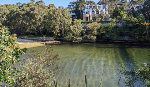
There’s a turquoise natural water hole suitable for swimming, and not far from it there’s another pool on the river bend. It’s the kind of place where you’d expect to find crowds (taking pictures and posting hundreds of them on Instagram), but hey, this is Australia. Stunners like this often go unnoticed, because this country is giant and full of hidden beauty.
The trail follows the creek all the way, but it’s not a leisurely walk, rather a jungly adventure.
Gibberagong Track hiking information:
- Trailhead: Bobbin Head picnic area (or Grosvenor Street in Wahroonga)
- Length: 6.3 km one-way
- Difficulty: easy
- See the route on a map here.
Have good quality, responsibly sourced food for the trail
For longer walks, we usually add one or two more filling, higher‑quality snacks to our usual simple food — they’re not cheap and we don’t bring them every time, but on longer hikes they make a real difference to tired bodies:
Best time to visit Ku-ring-gai Chase National Park
Any day is a great hiking day in Sydney. Probably summer is the worst time to hike because of the heat, but you can still take advantage of cloudy days, or choose a hike that leads to a beach or a natural water pool. Winters are mild and you’ll be happy to soak up the sunshine, so most of the unshaded trails are the most enjoyable in winter. But then spring brings tons of wildflowers.
Do I say that any time of the year is the best time to spend a day outdoors? Yes. Among other things, that’s why I love Sydney so much.
Facilities in Ku-ring-gai Chase National Park

The park has two main areas, and they can be accessed via different entrances: the Bobbin Head area and the West Head area.
The Bobbin Head area is a favorite picnic spot for local families on any sunny weekend, and it has all the facilities you could wish for: toilet blocks, picnic benches, BBQs, canoe launch and boat launch area, a nature themed playground and some lovely forest trails.
The West Head area is more untouched. Most trails start along West Head Road from a pullout or small parking lot, and the only well-equipped picnic area is towards the end: the Resolute picnic area. It has toilets (the only ones in the West Head area!), benches and BBQs. Nearby west Head Lookout also has plenty of benches and picnic spots, but no toilets.
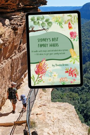
Looking for more family-friendly walks near Sydney?
Stop the guesswork! My Sydney’s Best Family Walks ebook gives you 50 kid-tested trails with all the details you need: maps, parking, difficulty, pram access, and unique “Play Factor” notes. Plus, get 130+ bonus nature play ideas & printables!
Unlock stress-free family adventures.
Leave a Reply