We love taking a day trip from Sydney to the Central Coast. While we spend most of the time on the fabulous beaches in the summer, we enjoy the scenic Central Coast walks in winter and spring. And then there’s the best of both worlds: the beach hikes.
But first of all, where is the Central Coast? This region is north of Sydney, bounded by the Hawkesbury River in the south, the Watagan Mountains in the west and the southern end of Lake Macquarie in the north. It’s home to an amazing coastline, gorgeous national parks, laid-back coastal towns, countless lakes and even more beaches. Whether you’re looking for a few kilometers long family-friendly coastal walk, or a longer, more challenging hike (not too challenging, don’t worry, these are not mountains), there’s something for you.
In this post we collected the best Central Coast hikes we’ve found on our day trips from Sydney.
Best place to stay on the Central Coast:
- luxury: Beachside Villa in Ettalong Beach (southern Central Coast), The Beachcomber Hotel & Resort in Toukley (northern Central Coast)
- mid-range: NRMA Ocean Beach Holiday Resort in Umina (southern Central Coast), Ibis Styles The Entrance (northern Central Coast)
- budget: Nightcap at Ocean Beach Hotel in Ettalong Beach (southern Central Coast), Blue Lagoon Beach Resort in The Entrance (northern Central Coast)
Best Central Coast walks
Bullimah Spur Track, Bouddi National Park
If you’re looking for an easy Bouddi National Park walk that takes you to wonderful views, the Bullimah Spur Track is for you. It runs mainly in the coastal forest, among pretty gum trees, occasional sandstone outcrops and lush ferns (it’s among the most scenic Central Coast bush walks), but leads you to several spectacular viewpoints.
The Bullimah Outlook is at the end of the trail, but keep an eye out for side trails before the final lookout. They’re just as stunning.
The Bullimah Spur Track is short, but it’s a hike, not a flat walk, and you better wear proper hiking shoes with good grip (like the Columbia Newton Ridge Plus, both for women and men). The terrain has uphills and downhills, occasionally roots and rocks. It’s mostly shaded, so it could be a great hike for a summer morning or late afternoon.
The Bullimah Spur Track and the Maitland Bay Track share the same trailhead and beginning. If you’d like to spend the rest of your day on a secluded, relatively sheltered, beautiful beach, hike down to Maitland Bay once you return from the Bullimah Outlook. The Maitland Bay Track is 2 km return, and mostly steep downhill on a long stairway (then uphill on the way back).
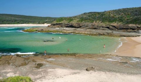
Maitland Bay is among my favorite places to swim on the Central Coast. Though the beach is not patrolled, it’s sheltered and usually calm enough. And it never gets crowded.
Hiking essentials:
- Trailhead: Maitland Bay Information Center
- Length: 2.4 km return
- Difficulty: easy
- See the Bullimah Spur Track on a map here.
Sydney Family Walks Made Easy!
Get my guide to 50 kid-tested trails with maps, parking, pram info & fun “Play Factor” notes. PLUS: 130+ nature play ideas & printables!
Box Head Lookout, Bouddi National Park
One of the most scenic Bouddi National Park walks is the one to Box Head Lookout. It’s short, easy and very rewarding. It runs on a narrow peninsula, bordering the Tasman Sea and the Hawkesbury River, offering excellent ocean views, and also views of Tallow Beach and Little Tallow Beach.
Getting to the trailhead of the Box Head Track can be challenging though. The trail starts at the end of Hawke Head Drive, and this road is not paved and quite bumpy. Drive carefully, especially if you have a low clearance car.
If you’d rather not drive on rugged, unsealed roads, you can choose to park at the trailhead of the Flannel Flower track (along High View Road). This won’t involve any driving on unsealed roads, but adds the 1.4 km Flannel Flower walking track to the hike. Even if you’d wish to make the hike longer, this is a good option, and the Flannel Flower walking track is especially pretty in spring.
At the end of the Flannel Flower track, you can continue on the Box Head track. (You can also walk down to the wild, beautiful and very unprotected Tallow Beach, which is another optional addition.)
The Box Head track runs on a wide fire trail in the beginning, but it won’t be long until you get your first views from the rocky outcrops, followed by more as you go. The very last section leads you to the tip of the peninsula, and you’ll see the ocean both on your left and on your right. Finally, you can sit down at Box Head, enjoying the panoramic views and some snacks, before returning back on the same way.
You might spot a passing whale between May and August (the prime whale-watching season), so don’t forget a compact set of binoculars.
Hiking essentials:
- Trailhead: at the end of Hawke Head Drive
- Length: 3 km return
- Difficulty: easy
- See the Box Head Lookout track on a map here.
Bouddi Coastal Walk, Bouddi National Park
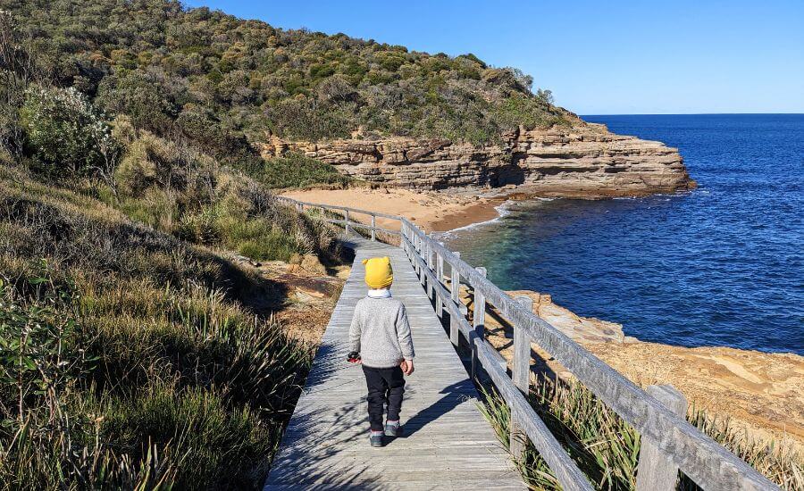
The Bouddi Coastal Walk is one of the longest Central Coast coastal walks, down at the southern end of the region. It runs between Putty Beach and MacMasters Beach for about 8.5 km. It follows the coastline, while running up over bluffs and down along beaches.
The very first section from Putty Beach to Maitland Bay is particularly impressive, with fabulous coastal views at every step. Bullimah Beach is right along the trail, there’s a steep staircase down to the beach. After passing Maitland Bay the trail runs further from the top of the coastal cliffs, but still offers occasional ocean views. You can take another short detour to Little Beach.
Gerrin Point Lookout and Bouddi Point Lookout are not only fantastic viewpoints, but great whale-watching spots, too (mainly between May and August).
Part of the Bouddi Coastal Walk is on boardwalk, and the full length of the trail is very well-maintained. It’s a relatively easy trail, but there are uphills and downhills, and several long staircases to climb.
impressive rock formations along the Bouddi Coastal Walk
If you’re hiking with young kids, do the section from Putty Beach to Bullimah Beach.
Hiking essentials:
- Trailhead: Putty Beach
- Length: 8.5 km one-way
- Difficulty: medium
- See the Bouddi Coastal Walk on a map here.
Spion Kop lookout, Brisbane Water National Park
It’s among the lesser-known Brisbane Water National Park walks, but offers an unforgettable panorama at the end. It also has a wide variety of colorful flowers on display in the spring months. It’s one of the best hidden hikes in the Central Coast!
Since it’s long enough and not marked either, I’ll explain about the route a bit more than usual. The trailhead for Spion Kop lookout is at Bambara Fire Trail on Woy Woy Road. There’s a large dirt car park. Then you start walking on the Bambara Fire Trail, until you reach the crossing with the Koolewong Fire Trail. Here you take the Koolewong Fire Trail, but won’t follow it all the way. Keep your eyes open for another, unmarked crossing. It’s easy to notice, especially if you’re on the lookout for it, and it should lead you to a creek crossing.
You need to follow the creek bed downstream for a short while, and pay attention to the trail on the other side of the creek. Now, this one is easy to miss! But here’s some help: the creek bed doesn’t look that easy to follow anymore, and among the large rocks on the side, you notice a narrow, but obvious hiking trail that ascends out of the creek bed. This part of the hike can be more challenging in wet weather and after heavy rains. When we hiked, there was barely any water in the creek.
the creek and the path that leads you out of the creek bed
After the creek crossing comes the most enjoyable part of the trail. The path is obvious, though steep and slippery at places, and you’ll pass through natural walkways through boulders. You’ll get to an unexpected lookout over Waterfall Bay. You’re on the right track, but not there yet. As nice as this lookout is, Spion Kop is much more impressive, so continue a bit further.
Finally, you’ll find yourself on top of the large rock outcroppings – from where you can marvel at Woy Woy and Woy Woy Bay. There are two different viewpoints, and they’re only a few steps from each other, so check out both, they offer a slightly different view of the bays below.
Spion Kop hiking info:
- Trailhead: the crossing of Bambara Road and Woy Woy Road
- Length: 5 km one-way
- Difficulty: medium
- See the Spion Kop hike on a map here.
Pearl Beach to Patonga Beach walking track, Brisbane Water National Park
The Pearl Beach to Patonga Beach walk (or Patonga to Pearl Beach walk, if you start it from the other end) is a bushwalking track, with steep uphills and downhills and a few impressive lookout points on the way. You’ll end up at Patonga Beach, which is a very sheltered beach in Broken Bay.
The trailhead is at the end of Crystal Avenue. There’s no dedicated parking lot, just park in the pullouts along the road. You’ll easily notice the fire trail which starts among pretty cabbage palms. Being a fire trail for quite a while, it’s still a lovely walk thanks to twisted eucalyptus trees, some large sandstone rocks and lots of spring flowers.
About halfway you find the Warrah Lookout. The natural rock platform looks over Broken Bay and the Hawkesbury River. After this viewpoint, the trail towards Patonga Beach gets narrower, steeper – and also more exciting. It takes you down to Patonga Beach. Take your time on the descent; collapsible trekking poles can be a blessing for knees.
Pack everything into a comfortable daypack with a chest strap for stability on the inclines. Once at Patonga, cool your feet in the gentle waves before bracing for the uphill return.
Hiking essentials:
- Trailhead: at the end of Crystal Avenue in Pearl Beach
- Length: 3 km one-way
- Difficulty: medium
- See the Patonga to Pearl Beach track on a map here.
Find this guide helpful?
If my articles have helped you plan an adventure or see a place a little differently, you can say thanks by buying me a virtual coffee.
This site is ad‑free and independent, and every small contribution helps me keep creating thoughtful, experience‑based travel guides. No pressure at all — but thank you if you choose to support it.
Piles Creek loop, Brisbane Water National Park
Brisbane Water National Park is home to several exciting, not too well-known and relatively easy bushwalks on the Central Coast. The 4 km long Piles Creek loop track takes you through a dry eucalypt forest along Piles Creek, passing a few cascades, several gullies and crossing a suspension bridge on the way. It’s one of the best bush walks on the Central Coast.
The track remains interesting all the way: lush gullies, large rock overhangs and caves, a viewpoint over the gorge, the suspension bridge and a waterfall lookout. In late winter and spring you can enjoy an amazing display of wildflowers and flowering trees – boronias, Golden Wattle trees, wax flowers, spider flowers, fuchsias and lots more.
With some steeper sections and the occasional series of stairs, it’s a proper hike – though a short one. Hiking shoes are recommended. While it’s not a particularly toddler-friendly trail, kids of age 4 and above will probably find it a fun challenge. Just watch out as there are a few exposed and steep sections, hold hands if needed.
The trailhead is at the Girrakool picnic area, and the Piles Creek loop track is clearly marked. You can combine it with the Girrakool loop and the Girrakool Aboriginal Engravings, another bushwalk that adds another 2 km.
Hiking essentials:
- Trailhead: Girrakool picnic area
- Length: 4 km loop
- Difficulty: medium
- See the Piles Creek walking track on a map here.
Somersby Falls, Brisbane Water National Park
Somersby Falls is one of the most easily accessible and prettiest Central Coast waterfalls. Being only a few hundred meters away from the parking lot, it’s popular among local families, and it’s also a great quick stop on your drive from Sydney to Brisbane.
The path starts from Somersby Falls picnic area, and it takes you to the bottom of Somersby Falls. Though it’s short, it has a set of long stairs, and the terrain is steep and uneven. But quicker than you think you’ll stand at the bottom of Somersby Falls, refreshing yourself in the cool spray.
Keep your eyes open for birds, water dragons, frogs and goannas, too. Bring a compact picnic blanket for lounging on the smooth rocks.
Hiking essentials:
- Trailhead: Somersby Falls Picnic Area
- Length: 0.5 km return
- Difficulty: easy
- See the Somersby Falls Track on a map here.
The Coast Walking Track, Wyrrabalong National Park
Wyrrabalong National Park is one of those Central Coast national parks I’ve never heard about before. It’s a small park, but is home to dramatic views and unique plants. Its most famous trail is the Coast Walking Track, also known as Wyrrabalong Walk. (I know, there’s a “coast walking track” in every national park. Luckily, we can’t ever get bored of scenic coastal walks.)
It’s 3 km long, and runs between Forresters Beach (Wyrrabalong Lookout) and Bateau Bay. Our favorite season to do it is winter, because you can spot whales, but spring, too, because thousands of wildflowers bloom along the trail. Well, summer is not bad either, because Bateau Bay is a stunning beach to cool down and take in the wild scenery.
Though the Coast Walking Track offers a few viewpoints, most of it is in the coastal forest. Hence you’ll likely find it the most impressive in the whale-watching season (between May and August) and during the wildflower blooming in spring. Just don’t forget to bring a compact pair of binoculars for those thrilling whale sightings.
You can start this hike from either end (at the end of Cromarty Hill Road near Wyrrabalong Lookout, or at the Bateau Bay Beach parking), or even from the middle, because the Crackneck Point lookout is accessible by car, and there’s a huge parking lot right at the viewpoint. So you can break down this short hike to be even shorter in case you’re with small kids or simply lack time.
The walking track is quite easy, some of it is even paved, but you also find several series of stairs along the way.
Hiking essentials:
- Trailhead: Bateau Bay Beach parking or at the end of Cromarty Hill Road near Wyrrabalong Lookout
- Length: 3 km one-way
- Difficulty: easy
- See the Coast Walking track on a map here.
Norah Head Lighthouse loop
This easy headland loop offers a variety of beautiful scenery and views. It includes a walk through coastal forest on the Norah Head Nature Trail, viewpoints by the whitewashed lighthouse, then a walk on coastal cliffs and on a sandy beach, ending the loop at Norah Head Rockpool. It’s one of the best coastal walks on the Central Coast for families.
You’ll start the walk from the Bush Street Reserve parking lot, or you can also choose to start from the Norah Head Lighthouse car park. Bush Street Reserve and the Norah Head Lighthouse are connected by the Norah Head Nature Trail, which is a lovely coastal forest path, with occasional ocean views. But the best coastal views are from the lookouts surrounding the lighthouse.
Take the staircase down to Norah Head, wander on the rocks, admire the waves crashing into them, or observe the rock pools. One of my favorite whale-watching memories is also from Norah Head: I saw a humpback whale playfully jumping out several times on a bright August day.
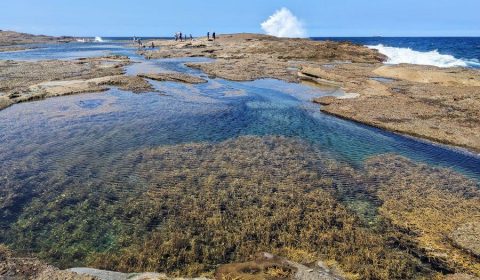
The second half of the loop leads you right by the water, among tidal pools and in the soft sand on Nimbin and Lighthouse Beaches. The turquoise water is very tempting on a hot day, and the Norah Head Rockpool at the end is a safe place for kids to splash around, too. This is actually a natural rock pool, not a concrete swimming pool. It’s an area barricaded by rocks so that the shallow water is more sheltered. Norah Head Beach itself is somewhat sheltered, as well.
You can return to the Bush Street Reserve parking area on a long stairway from Norah Head Rockpool.
Hiking essentials:
- Trailhead: Bush Street Reserve parking lot in Norah Head
- Length: 2.4 km loop
- Difficulty: easy
- See the Norah Head track on a map here.
Wonga Point loop, Bateau Bay
Honestly, based on the length of the walk, the Wonga Point loop wouldn’t deserve to be on this list. But then there’s the scenery!
The Wonga Point loop is a 1.5 km return trail from the Bateau Beach parking lot, and it offers an easy, lovely forest walk to some fantastic viewpoints of Bateau Bay. There’s a grassy picnic area right by the parking lot, overlooking Bateau Bay Beach, and a nice, paved pathway leads you to the headland northwards.
Signs indicate “Wonga Point loop”, and a mostly flat, dirt pathway takes you around the headland. Keep an eye out for the side tracks to the lookout points. They might be narrow and a bit slippery, so watch your steps. But they’re certainly well worth it.
Then you can walk down to Bateau Bay Beach for a swim. This loop can also be combined with Wyrrabalong Walk, which starts from the Bateau Bay Beach parking, and runs southwards.
Hiking essentials:
- Trailhead: Bateau Bay Beach parking
- Length: 1.5 km loop
- Difficulty: easy
- See the wonga Point loop track on a map here.
Coastal walking track, Wallarah National Park
Strictly speaking, this is not the Central Coast – but almost, just a bit north of it. And it’s such a wonderful coastal walk that I can’t stand leaving it out from this list. This is a track from Caves Beach to Pinny Beach, following the coastline.
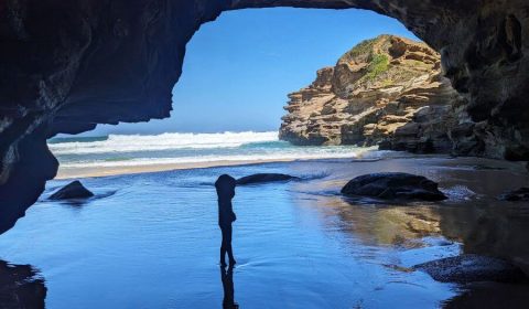
Caves Beach is one of the most special beaches in New South Wales. As you might have guessed from the name, it’s home to spectacular caves, and you can walk through them at low tide. With or without kids, it’s real fun!
The coastal trail starts above the caves, from the Caves Beach parking lot, which is also your first viewpoint, looking over Caves Beach and the coastline. You’ll continue south on a well-marked trail. Shortly after leaving Caves Beach, one section of the trail runs on the roadside of Caves Beach Road, but don’t worry, you’ll soon return to a peaceful, unspoilt landscape.
The walk is easy enough, but it’s a mix of gentle uphill and downhill sections. You’ll pass Spoon Rocks, with two stunning beaches on the sides. Walking all the way until the end of the narrow peninsula is only possible at low tide (and be very careful with tide times if you decide to walk, because waves can be powerful and sweep you off the cliffs as the tide is rising).
My favorite half of the track comes after Spoon Rocks. It offers undisturbed coastal views at every step, as you descend to Pinny Beach through the headland.
Pinny Beach is a wild one, with powerful currents, and you’re guaranteed to find solitude here. Then you return back the same way. Continuing further south is also an option, you can get to Shark Hole or Bogey Hole.
As all coastal trails in the area, this one is also great for watching humpback and southern right whales during the winter months.
Hiking essentials:
- Trailhead: Caves Beach parking lot
- Length: 5 km return
- Difficulty: easy
- See the Wallarah coastal walking track on a map here.
5 Lands Coastal Walk
The 5 Lands Walk is a bit of an exception again. It’s not simply a walk, but a cultural event, too. It takes place in June each year, and it includes a 10 km walk between MacMasters Beach and Terrigal Beach, roughly 20,000 participants, art, music and food.
The 5 Lands are the five beaches and coastal communities on your way: McMaster’s Beach, Copacabana Beach, Avoca Beach, North Avoca Beach and Terrigal Beach. You can, of course, do this walk any time of the year you fancy, but the community event makes it more special.
It’s an easy hike, but still there are several hills, steep sections and long stretches of beach (which means you’ll walk in the sand), so it’s definitely more than just an afternoon stroll on the oceanfront promenade.
Want amazing Sydney family walks without the planning headache?
My ebook features 50 detailed, kid-approved trails with maps, parking, pram info & fun “Play Factor” highlights. PLUS: 130+ nature play ideas & printables to get your family outdoors!
Spend less time searching, more time exploring. Get your instant download!
Where to stay on the Central Coast?
You can explore the Central Coast from one base, you can choose to spend one or two nights at different locations, or you can visit it on a day trip from Sydney. The ideal option for you depends on how much time you have, which parks and beaches you plan to visit and how much you’re willing to drive.
It’s not a large region, but it’s cut by quite a few bays and lakes, so getting from one place to the other might take a while. The M1 motorway (the “Legendary Pacific Coast Highway”) runs further from the coastline as you pass the Central Coast, and it means about a 25-40 minutes drive to get to the coast from the motorway.
Gosford area
It’s a great location to explore the southern Central Coast, including Brisbane Water and Bouddi National Parks.
Luxurious accommodations in the Gosford area
For a truly luxurious stay, you can book this three-bedroom penthouse in Gosford. It offers wonderful ocean views and an outdoor jacuzzi to savor them even more! The location is excellent, you’re right by the Gosford waterfront, and the trails of Brisbane Water National Park or Bouddi National Park are roughly half an hour drive away. Though the ocean coast is close, it’s not a beachside stay. The closest beaches are within 20-30 minutes drive, like Avoca Beach, Putty Beach or Ettalong Beach.
If you’re looking for a luxurious beachside stay, this two-bedroom beachside villa in Ettalong Beach is a great choice. It’s walking distance from both Ettalong Beach and Umina Beach, two amazing, relatively sheltered beaches in Broken Bay. It has a private tropical garden, huge, modern living and dining areas, a well-equipped kitchen and an outdoor gas BBQ.
Mid-range accommodation: NRMA Ocean Beach Holiday Resort, Umina
The NRMA Ocean Beach Holiday Resort in Umina is right behind Umina Beach, and it offers a variety of villas, rooms, cottages, permanent tents and lofts to choose from. The price hugely depends on the type of accommodation, but you can find both luxurious and more affordable options. Guests can enjoy heated resort pools and spas, a water park, BBQ areas, playground, go-karts and other fun family activities.
Most trailheads in Bouddi National Park are about 15 minutes drive away, and the trails of Brisbane Water National Park are half an hour away. It’s about a 10 minutes drive from Pearl Beach and Patonga Beach, which lie on an isolated end of the peninsula.
Budget-friendly accommodations in the Gosford area
If you’re looking for budget-friendly accommodation, we have two suggestions. One is in Gosford: the Ashwood Motel. It offers rooms of different sizes, a pool, ping-pong and BBQ facilities. It’s great to explore the trails of Brisbane Water National Park and Bouddi National Park (both are half an hour drive away), but it’s a beachside location (the closest beaches are within 20-30 minutes drive away).
A budget-friendly stay closer to beaches is the Nightcap at Ocean Beach Hotel in Ettalong Beach. It’s a few minutes walk from Umina Beach, and a few minutes drive away from Ettalong Beach or Pearl Beach. The Bouddi National Park walking tracks are about 15 minutes drive away, and the ones in Brisbane Water National Park are half an hour drive away.
3-star Ocean Beach Hotel has an on-site bar and bistro, and you can choose from various types of studios.
Accommodation near The Entrance
Base yourself near The Entrance to explore the northern area of the Central Coast, including Tuggerah Lake, Bateau Bay, Wyrrabalong National Park or Norah Head.
Luxurious accommodation near The Entrance: The Beachcomber Hotel & Resort, Ascend Hotel Collection, Toukley
5-star The Beachcomber Hotel & Resort in Toukley offers an excellent location for water lovers. Being built on the narrow strip of coastline between Budgewoi Lake and Tuggerah Lake, it’s a romantic place to relax and enjoy sunsets, with cocktails in hand. Guests have access to an outdoor pool, playground, games room and an onsite bar and restaurant, and some rooms have amazing lake views and a pampering spa bath.
Norah Head Lighthouse is only 15 minutes drive away, and the nearest ocean beaches are Hargraves Beach and Lakes Beach, both 5-8 minutes drive away. The Norah Head Rockpool is an ideal sheltered area for kids to play in a natural rock pool.
Mid-range accommodation near The Entrance: Ibis Styles The Entrance
If you’re looking for a more affordable hotel stay, the Ibis Styles The Entrance, right by the shore of Tuggerah Lake is a great option. This 4-star hotel offers various types of simple, modern rooms for different budgets.
It’s close to the Tuggerah Lakes Park and a nice waterfront walking path. The closest ocean beaches are Shelly Beach and Toowoon Bay, and you’re a short drive away from Wyrrabalong National Park and Norah Head.
Budget-friendly accommodation near The Entrance
You find fabulous budget-friendly options, too. The Blue Lagoon Beach Resort is only a short walk away from Shelly Beach, and it offers cabins of different sizes, a heated outdoor pool, spa area and a tennis court. All cabins have a balcony and outdoor furniture so that you can enjoy the fantastic location. It’s also very convenient to drive to the beautiful beaches and trails of the northern Central Coast from here.
The same stands true for the Ocean Front Motel at The Entrance. Located on cliffs, it overlooks the ocean and The Entrance Beach. It offers a variety of rooms, some with stunning sea view, a balcony or a spa bath.
Your Central Coast hiking essentials: what we actually pack
After countless bushwalks and coastal rambles, here’s what I usually have for sensible comfort and peace of mind for those adventures that can easily end in a coffee shop (strictly before 3pm, otherwise you’d find them closed).
Footwear
- Proper hiking shoes with good grip, like the Columbia Newton Ridge Plus, both for women and men – Essential for rocky patches, slippery steps, and those unexpected mud puddles that mysteriously appear even after a dry spell. Don’t twist your ankle in flip-flops, most of these walks are not strolls on a paved promenade.
- Water shoes or reef shoes – If your hike ends at a beach or rock pool, these are a godsend to explore the rock at low tide.
Sun & insect protection
- Wide‑brimmed, adjustable sun hat (and this is my favorite for kids) – The Aussie sun is fierce even in winter. A hat with a chin strap means it won’t fly off when the coastal breezes decide to make an appearance.
- Reef‑safe sunscreen (high SPF) – Protects your skin and the beautiful marine life if you end up swimming. A good habit for every outdoor day.
- Insect repellent bands – For those lush, shaded bush sections or twilight walks.
Hydration & the fuel for fun
- Durable reusable water bottles (preferably metal to avoid microplastic) – Always carry more water than you think you’ll need.
- Electrolyte‑boosted drinks and energy bars – For those moments when the kids (or you) declare “I can’t possibly take another step!” . Most of the time these are simple snacks, like energy bars, but for longer hikes, we’ve learned to add one or two more filling options, like eggs, beef jerky, almonds and nuts (the point is: lots of protein!).
- Compact picnic blanket – For impromptu breaks, lunch with a view, or simply sitting on damp ground without getting a soggy bottom.
Safety & navigation (just in case)
- Compact first‑aid kit – Small scrapes, unexpected blisters, or a sudden spider bite (rare, but good to be prepared). Ours always has band‑aids, antiseptic wipes, and anti‑itch cream.
- Compact headlamp or small torch – For unexpected detours, chasing sunset views, or those bathroom visits at dusk.
- Printed map or reliable offline map app on your phone – Phone reception can be patchy in national parks. Don’t trust Google Maps blindly.
For the little explorers
- Child‑friendly binoculars – Turn any view into a treasure hunt for birds or distant boats.
- Small backpack for kids (with snacks inside) – They love carrying their own gear (if they don’t, they need to get used to it, anyway), and it gives them a sense of purpose.
Central Coast walks map
Finally, here you find all the walks on a map (click to open the interactive map):
Have good quality, responsibly sourced food for the trail
For longer walks, we usually add one or two more filling, higher‑quality snacks to our usual simple food — they’re not cheap and we don’t bring them every time, but on longer hikes they make a real difference to tired bodies:
