I think the best places can only be accessed on foot – who’s with me? I’ll prove my point for Sydney, our new home that we’ve been eagerly exploring ever since we arrived. The real magic of Sydney is the fabulous skyline, the turquoise bays and dramatic coastal cliffs, kookaburras sitting in the twisted gum trees and water dragons basking on the rocks. Sydney walks stole our hearts – and we help you fall for them, too, no matter the length of your visit.
In addition to all this, Sydney has a climate that’s perfect to be outside all year, so you can find a suitable scenic hike or walk any time of the year. Maybe combine it with some wading and swimming in the summer, because hot summer weather is the least suitable for hiking.
Best place to stay in Sydney:
- luxury: The Grace Hotel (4.5 stars, excellent location)
- mid-range: Cremorne Point Manor (scenic location, 10 minutes ferry ride from the CBD)
- budget: Nate’s Place Backpackers Sydney (hostel in Darlinghurst, a few blocks away from Kings Cross train station)
In this post we’ve collected all the best walks in Sydney: city walks to see the main attractions of the Sydney CBD, shorter and longer coastal walks, beach walks, bushwalks, and even the best hikes near Sydney. We’ve completed all of them – and I’ll keep adding to this list as we do more. So let’s see:
Best sightseeing walks in Sydney
First of all, let’s start with the best scenic walks in Sydney that allow you to see the main attractions of the city center. They’re great for first-time visitors, but never boring to locals either. They offer views of the jaw-dropping Sydney skyline, close views of the glass giants of the business district and Sydney Harbour.
Sydney Harbour Bridge Walk
When anyone thinks of Sydney, they think of the Opera House first, but then the Harbour Bridge. And the most iconic walk in the Sydney CBD is the walk through Sydney Harbour Bridge. It’s free, easily accessible and has its well-deserved place on every Sydney itinerary. It’s one of the best free things to do in Sydney!
Despite living here, we can’t get bored of it. We did this walk in different seasons and different times of the day, and it never ceases to impress. Night time is my favorite – or actually, late afternoon in the winter months when it gets dark after 5 pm. The Harbour Bridge walk is one of the best night walks in Sydney, and we found it especially magical when Sydney was lit up for the Vivid Festival. But the sunset over the bay is also spectacular.
view of the Opera House from the Harbour Bridge
How to access the Harbour Bridge?
It’s not particularly a walking bridge, it’s home to a train track and a busy seven lane highway, but it has a pedestrian walkway which is fenced on both sides. The pedestrian path is on the eastern side of the bridge (it has the best views!), while the other side is reserved for bikers. This means that you can access the bridge on foot only through the designated access points (both stairs and elevators), and you can’t cross the road once on the bridge (obviously).
The walk starts at the Bridge Stairs in The Rocks, right off Cumberland Street – and don’t worry, there’s an elevator, as well. It’s a pram-friendly and wheelchair-accessible walk. Once you’re up, turn left and cross the bay on the bridge. The views are fantastic, but the safety fence somewhat obstructs them, and you can’t see anything to the west. Luckily, the best views, the Opera House, the CBD skyline and the Circular Quay are to the east.
When you reach Milsons Point, the stairs (and another elevator) will take you down at the crossing of Burton Street and Broughton Street in North Sydney.
| Essential info: |
|---|
| Length: 1.6 km one-way |
| Difficulty: easy, flat and paved |
| Pram-friendly? yes |
| See the Harbour Bridge walk marked on a map here. |
Is it worth walking the full length of the Sydney Harbour Bridge?
If you have the time, then yes. The views are very enjoyable all the way, and you can walk down to Broughton Street Lookout and Milsons Point Lookout in North Sydney, after you complete the bridge walk. A nice way to get back to the city center is taking the ferry from Milsons Point Wharf to Circular Quay. This short ferry ride will also reward you with amazing views of the Sydney skyline, the harbour and the Opera House from the water.
However, if you’re short on time, walk only to the Pylon Lookout and back. It’ll treat you with good enough views of the Opera House and Sydney Harbour.
Barangaroo Foreshore & Reserve
This lovely walk through the Barangaroo Foreshore and Reserve offers views of the Harbour Bridge, Luna Park, Darling Harbour, Goat Island and the shiny, new glass giants of Barangaroo.
The main path called Wulugul Walk starts at the Hickson Road entrance, and it encircles Barangaroo Reserve. I highly recommend taking the stairs and paths up the hill to the Reserve and the Stargazer’s Lawn for even more views. This multi-level park is one of the prettiest green spaces in Sydney’s center, and you can easily connect this walk to one in The Rocks or in Darling Harbour at the other end.
| Essential info: |
|---|
| Length: ~2 km one-way |
| Difficulty: easy, mostly flat and paved |
| Pram-friendly? partially (there are stairs, but they can be avoided) |
| See the Barangaroo walk marked on a map here. |
The Royal Botanic Garden
One of the best nature walks in Sydney is simply walking in The Royal Botanic Garden. Though you’re in the very heart of the city, you instantly forget this as you enter this majestic, heritage-listed, 30-hectare botanic garden – which is free to visit!
Stroll the harbourfront walkway, visit the various themed gardens and the wide lawns with fantastic views. Marvel at the different species of trees from Australia and all over the world. Join a free guided tour in the Government House on Fridays, Saturdays and Sundays. You find a restaurant, cafe, visitors center and a bookshop at the Palm Grove Centre.
I won’t provide any planned walking route, because you find maps of the garden at every gate. Walk around as you please, it’s easy to spend several hours exploring this garden. It’s open and free to visit every day, but it closes for the night, so check the opening hours before your visit, they change with the seasons.
Sydney Family Walks Made Easy!
Get my guide to 50 kid-tested trails with maps, parking, pram info & fun “Play Factor” notes. PLUS: 130+ nature play ideas & printables!
Cahill Walkway
Cahill Walkway is one of the most beautiful walks in Sydney, linking The Royal Botanic Garden with Milsons Point. It includes the Sydney Harbour Bridge walk (that’s the northern portion of the Cahill Walk), but it continues along the Cahill Expressway, spanning for 2.2 km one-way.
There’s a fenced pedestrian walkway all the way along the busy expressway, and the walk ends at Macquarie Street, just outside the Northern Depot Gate of the Royal Botanic Gardens. There’s another access point from the eastern side of Circular Quay, via an elevator, and yet another one from the end of Gloucester Street in the Rocks, via an accessible ramp.
The Cahill Expressway pedestrian path offers close views of the skyline and the best views over Circular Quay. It doesn’t sound tempting to walk along such a busy road, does it? But the elevated walkway rewards you with stunning views of the area from above. It’s an urban walk, but a very picturesque one.
There’s no shade on this walking path though, so cover yourself if you do it in the summer. And soak up all the sunshine on winter days. 🙂
| Essential info: |
|---|
| Length: 2.2 km one-way |
| Difficulty: easy |
| Pram-friendly? yes |
Darling Harbour & Pyrmont Bridge
Darling Harbour is one of the best places to walk in Sydney. It’s a cove on the western outskirts of the CBD, and there’s a scenic waterfront pathway circling it, and historical Pyrmont Bridge spanning over it. Along the way you find plenty of cafes, restaurants, outdoor spaces and museums: Tumbalong Park, the International Convention Centre, the Australian National Maritime Museum and its outdoor exhibits (right, I mean ships docked in the bay), the Madame Tussauds Sydney or the SEA LIFE Sydney Aquarium.
Pyrmont Bridge is the loveliest bridge in Sydney. The original wooden bridge was replaced in 1902, and the new steel bridge was ready to welcome Sydney’s first cars. But nowadays, the heritage-listed swing bridge is reserved for pedestrians and bikers only, and it offers stunning views of Cockle Bay, Port Jackson and the CBD.
It’s a 3 km loop to walk all around Darling Harbour, but there’s so much to do here! The Barangaroo and Pyrmont Bay ferry wharfs connect it with Circular Quay, and any of these ferry rides are exceptionally scenic.
| Essential info: |
|---|
| Length: ~3 km loop |
| Difficulty: easy |
| Pram-friendly? yes |
| See the Darling Harbour walk on a map here. |
The Goods Line
The Goods Line is not only one of the best walks to do in Sydney, but also a great example of how to turn a dead part of town into an attractive outdoor space. The abandoned railway tracks were turned into a green walkway that connects Central Station and Darling Harbour. You’ll walk under large fig trees and enjoy urban views. The most impressive building on the way is the Business School of the University of Technology Sydney, designed by Frank Gehry.
It’s a short pathway, but lovely and easy – and also easily added to any sightseeing walk you planned for the day. The flat surface is suitable for prams and wheelchairs, too. There are stairs at one end, but you find alternate ramp access. If you start from the Central Station, look for the Devonshire Street Pedestrian Tunnel, that’s the most convenient access point to the Goods Line.
You might have realized by now that all the walks mentioned in this section can be connected with each other, and completing them means you’ve seen the best of Sydney’s city center. So pick as many as you like, and enjoy the amazing Sydney views.
| Essential info: |
|---|
| Length: ~500 m one-way |
| Difficulty: easy |
| Pram-friendly? yes |
| See the Goods Line walk on a map here. |
Best coastal walks in Sydney
Okay, so you’ve completed the best urban walks, but as for exploring the best walking trails in Sydney, you’re not nearly done. Sydney has more than a hundred beaches and a fabulous coastline. The trails in this section deliver impressive coastal views, romantic beach walks or access to picturesque little coves. They make me feel that Sydney and the ocean are inseparable – and they are.
TOP 3 Sydney coastal walks
It’s not easy to pick favorites, because each coastal hike has its own charm. But for those of you who have a limited time, I highlighted three of my all time favorite coastal hikes in Sydney.
Bondi to Coogee Walk, Eastern Suburbs
Looking for nice walks in Sydney while also visiting some of the city’s most famous beaches? The Bondi to Coogee Walk combines the two. If you only choose one coastal walk in Sydney, let it be this one, because it’s epic. You can do only a part of it, and it’s still epic.
What makes it so special? The giant, powerful waves, the pretty bays, the dramatic sandstone cliffs. And it’s a cultural experience, too, witnessing the Aussie beach lifestyle. The Bondi to Coogee walk is one that makes you want to move to Australia right away (you can believe me, hah). It makes you realize that Sydney is the most beautiful coastal city in the world.
The walkway runs parallel to golden sand beaches and sandstone cliffs. The path is paved, but occasionally you need to take steep sections of stairs. It’s definitely not pram-friendly, have a baby carrier for the little ones instead. (3-year-old Tomi actually completed it on his balance bike, and we carried it up the stairs for him, it worked well for us. For the most part it’s an easy walk on pavement.)
You’ll pass Bondi Beach, Tamarama Beach, Bronte Beach, Clovelly Beach, Coogee Beach and Gordon’s Bay on the way. Swim at whichever beach you fancy (you won’t be able to resist, anyway, if you’re doing this walk in the summer), and snorkel the Gordons Bay Underwater Nature Trail. With the one exception of Tamarama Beach, the rest has rock pools, so you can choose to swim there if you find the sea conditions too rough.
Along the way you find parks, picnic tables, kiosks, playgrounds and toilet blocks. The best beaches with kids are Clovelly Beach and Bronte Beach. Clovelly Bay is extremely sheltered, so the water is usually calm, with gentle waves. Bronte Beach has the Bogey Hole, a big natural rock pool at the southern end of the beach, with a sandy entrance and shallow water, ideal for small kids to play in the water.
Between Bronte Beach and Clovelly Bay you find Waverley Cemetery, a historical cemetery overlooking the ocean. It’s open to the public, and you can take a walk among the monuments. Several famous Australians were buried here.
| Essential info: |
|---|
| Length: ~7.3 km one-way |
| Difficulty: easy-medium |
| Pram-friendly? no (lots of stairs) |
| See the Bondi Beach to Coogee Beach walk on a map here. |
How to make the Bondi to Coogee walk shorter?
It’s absolutely worth doing this walk all the way. But if you don’t have the time, do the Bondi to Bronte walk, which is a ~2.5 km one-way portion of the iconic walkway.
If you walk the full 7 km, you can use public transport to get back to the beginning. It takes about 40 minutes to get from Coogee Beach to Bondi Beach by bus (two buses, actually, with a change at Bondi Junction).
Bondi to Coogee walk parking
The one reason we’d never start this walk at Bondi Beach is parking. It’s expensive and limited near Bondi Beach. Coogee Beach has somewhat better options, with a metered car park in front of Coogee Pavilion (at the northern end of Coogee Beach), and even free on-street parking if you’re lucky. The latter is not directly at the beach though, you should walk 10-15 minutes. Start your search along Brook Street, just behind the oval.
But the easiest parking is at Clovelly Bay. There’s a huge parking lot right by the beach, and lots of on-street parking in the streets behind. It might not be a suitable start for everyone, but if you’d do an out-and-back in each direction, or a Clovelly to Bondi walk, you can take advantage of the easy parking.
Barrenjoey Lighthouse Walk, Northern Beaches
Not anywhere near the city center, at the northernmost tip of the Northern Beaches, the trek up to Barrenjoey Head offers a spectacular coastal panorama. It’s one of the best hikes in Sydney – impressive, short and steep.
Governor Phillip car park near Palm Beach is the closest place to park for this walk. Pittwater Council parking fees apply, and they are not cheap. Generally, free street-parking is not too hard to come by in the Northern Beaches, but the tip of this peninsula is an exception. Parking on the back streets might be possible, but it adds a few kilometers to the walk.
It starts as a bushwalk and goes straight up the side of the headland, with some steeper sections and quite a number of stone stairs. The trailhead is on the western side of the peninsula (the Pittwater side), so even if you walk on Palm Beach (which is the nicer side), you need to cross the narrow peninsula to find the first stairs towards the lighthouse.
But the best views on the walk are not from the lighthouse, and not even from the top of the headland. There are two routes to the top: the wide and more gentle Access Trail and the shorter, steeper Smugglers Track. The best views are about halfway up the Smugglers Track, from several rock platforms just off to the side.
Some are easier to scramble up to than others, but they all rise above the trees and allow you to marvel at the breathtaking views of Palm Beach to the left, Broken Bay to the right and the tiny, green peninsula in between. It’s one of the most photographed viewpoints in the Northern Beaches.
Then you can continue up to the 19th century lighthouse that sits at Sydney’s northern-most point, enjoy views over Hawkesbury River, and bushwalk to a few other viewpoints on Barrenjoey Head. They are worthy to explore, but we found none of them as perfect as the ones halfway up.
On the way back you can take the Access Trail to make it a loop. Then you can take a long walk on Palm Beach and explore the sand dunes at the northern end of the beach.
| Essential info: |
|---|
| Length: 3 km loop (from Governor Phillip car park) |
| Difficulty: medium |
| Pram-friendly? no |
| See the Barrenjoey Lighthouse Walk on a map here. |
Hermitage Foreshore Walk, Sydney Harbour National Park
Unlike Barrenjoey Headland, the Hermitage Foreshore Walk is easily accessible from the CBD by the Rose Bay and Watsons Bay ferries (or bus lines, but they take longer and are less scenic). It’s a 1.9 km long scenic coastal walk that passes adorable beaches on the way. It starts at the end of Bayview Hill Road in Rose Bay and ends at Nielsen Park.
It’s partly shaded and relatively easy, but there are quite a lot of stairs along the way, so it’s not pram-friendly. (I didn’t know this, so I took my toddler in a pram for the first time we visited. Luckily, he likes stairs, so I asked him to get out and take the stairs while I carried up the pram. I think I wouldn’t have noticed how many stairs there are otherwise.)
We stopped at several beaches, Queens Beach and Milk Beach being our favorites, but there’s Hermit Beach, Tingira Beach and Shark Beach at the end. They are protected beaches, with calm water and gentle waves – it’s still inside Sydney Harbour.
The path offers distant views of the Sydney skyline, Shark Island, views of multi-million dollar mansions on the coast, and you’ll pass the famous historic Strickland House, too. In addition to the beaches, you find several picnic areas and benches along the way, as well.
Note for 2025: The construction of the concrete seawall at Nielsen Park is finished. Shark Beach is open again!
If you’d like to combine this walk with a ferry ride, you can take the F9 Watsons Bay ferry service. It stops at Rose Bay and Watsons Bay, too, so you can choose where to start. The walk from Rose Bay to Watsons Bay is almost 8 km though, and it includes the Hermitage Foreshore Walk (which is the nicest section) and also walking through residential neighborhoods and along the coast.
Since parking on this peninsula is very challenging, and most streets have time limited parking for non-residents, taking the ferry and walking the longer route is still the most convenient option for us, and it’s a lovely walk. You can take buses if you prefer walking less though.
| Essential info: |
|---|
| Length: 1.9 km one-way |
| Difficulty: easy |
| Pram-friendly? no |
| See the Hermitage Foreshore Walk on a map here. |
Best easy coastal walks in Sydney
Good news for those looking for easy hikes in Sydney: there’s plenty of them, and here we collected the ones that run along the coast. We especially like the short trails taking up to the headlands, and you can combine them with beach walks – or a lazy beach day in the summer.
Long Reef Headland, Northern Beaches
This 3.5 km loop is mostly paved, with a slight ascent and descent as it takes you around Long Reef Headland, passing nice beaches and offering views of Dee Why Beach and the rest of the bays to the south. Long Reef Point Lookout is an excellent whale watching spot in winter.
The headland is home to a golf course, the walking path circles it. Parking is the most convenient on Anzac Avenue at Griffith Park, just northwest of the headland. Then you’ll start at Fishermans Beach, the walking path is parallel to the beach at first.
As Fishermans Beach ends, you need to cross the road and look for signs for the Bicentennial Coastal Walk. This is a wide, paved path that takes you up to the Long Reef Point Lookout which is the highlight of this walk.
From there a long staircase heads down to the easternmost tip of the headland. It’s a popular fishing spot, but the rock platform is also exciting to explore at low tide, and there are plenty of shells washed to shore. This detour is the only part of the loop that’s not pram-friendly.
Then the loop continues from Long Reef Point Lookout towards Long Reef Beach, and this is the most scenic part, with views from the top of the coastal cliffs, as you slowly descend to the beach.
You can access Long Reef Beach, and it’s possible to walk all along this beach, then continue on Dee Why Beach, exploring the Dee Why Lagoon on the way. If you love long beach walks in the soft sand while waves are crashing at your feet, this is one of the best beach walks in Sydney. It feels remote and wild, and it’s not busy at all. Dee Why Beach and Long Reef Beach are so long that they can’t get truly busy ever, not even in the summer.
But the beach walk is not part of the loop. The Bicentennial Coastal Walk leaves the coast at Long Reef Beach, and loops you back to Griffith Park. This part is a short bushwalk, partly on a wooden boardwalk, then you’ll finish the walk on an open grassy area. You arrived at Griffith Park.
| Essential info: |
|---|
| Length: 3.5 km loop |
| Difficulty: easy |
| Pram-friendly? yes (the detour down the stars from Long Reef Point Lookout is not, but the rest of the loop trail is pram-friendly) |
| See the Long Reef Headland Circuit on a map here. |
Bangalley Head, Northern Beaches
One of the most scenic short hikes in Sydney is the Bangalley Head hike. It’s only a bit more than 1 km one-way, but it’s a hiking trail with a fair amount of steps and rocky, uneven surfaces. It’s still not difficult, but wear proper shoes so that you don’t twist your ankle, and bring water, because you’ll surely be thirsty as you ascend.
There are many open cliffs along the way, and they offer the best views. Just watch your steps, and keep small children close, because there’s no barrier.
The trail starts from the residential neighborhood and connects two streets. You can start at either end: from Marine Parade in North Avalon or to the left of 79 Whale Beach Road. There’s unrestricted street parking in the area. If you start at Marine Parade, follow the path among the houses to Bangalley Park.
You might feel like you’re in someone’s backyard, but it’s a public park, backed up by homes facing out onto the water (being a bit envious is acceptable). You’ll notice a narrow dirt path at the end of the park, that’s the way to go.
It’s an ascending trail, with roots and rocks, and you’ll get better and better views with each step. When you reach the first open cliff, you can enjoy amazing views across the Northern Beaches peninsula, and all the way to the city.
Take all the short detours to the cliff tops and viewpoints, those are the highlights of this short trail. On the other side, you’ll have 180-degree views of Palm Beach, the Central Coast, the Northern Beaches and the CBD. After the last viewpoint, the path descends into the bush. Continue towards Whale Beach Road, or go back the way you came.
| Essential info: |
|---|
| Length: 1.2 km one-way |
| Difficulty: easy |
| Pram-friendly? no |
| See the Bangalley Head walk on a map here. |
South Bilgola Headland, Northern Beaches
There’s a scenic coastal walking path that connects Newport Beach with Bilgola Beach. It’s basically a series of stairs up and then down, but thanks to the elevation you gain, you’ll enjoy fabulous views over both beaches.
The walk starts from the northern parking lot behind Newport Beach (you find plenty of free street parking on the back streets if you don’t have a council parking permit for the beach parking). You can choose to walk on the beach (in the sand) or on the South Bilgola Headland Boardwalk behind the beach. You’ll soon reach the beginning of the long stairway that takes you through scenic bushland and to nice coastal views.
There’s a similar stairway on the other side of the headland, taking you down to Bilgola Beach. If you only come for the viewpoints, walk to the views of Bilgola Beach on the northern side of the headland, then take the same way back.
Otherwise descend to the beach and have fun. Though Bilgola Beach is not as popular as some other beaches on the peninsula, it’s a beautiful golden sand beach with a rock pool at the southern end.
| Essential info: |
|---|
| Length: 1.3 km one-way |
| Difficulty: easy |
| Pram-friendly? no |
| See the South Bilgola Headland walk on a map here. |
Turimetta Headland, Northern Beaches
This 1 km loop hike around Turimetta Headland is a peaceful one, with a few lovely viewpoints along the way. You can park on the street on Narrabeen Park Parade and start on the gravel path. It’s an uneven, gravel / dirt trail, not suitable for prams or wheelchairs. It ascends and descends as you get around the headland, but it’s still very easy.
Unlike at other headlands, there’s no viewpoint at the tip of the headland here, they are on your way up and down. You can take a detour down through a long stairway to Turimetta Beach. It’s one of the least busy beaches in the Northern Beaches neighborhood, with high cliffs towering above the sandy bay. It’s a scenic beach with a remote feel, and it’s hard to believe that you are still in Sydney.
The trail loops back to the beginning through a nice bushwalk. If you’re up for a longer walk, you can continue further towards Narrabeen Head. (Let me tell you a secret: there’s a walking trail from Palm Beach all the way to Manly. Then from Manly all the way to Maroubra Beach.)
| Essential info: |
|---|
| Length: ~1 km loop |
| Difficulty: easy |
| Pram-friendly? no |
| See the Turimetta Headland Circuit on a map here. |
Western Escarpment Walking Track, Malabar Headland National Park, Eastern Suburbs
The Western Escarpment Track, also called Malabar Headland Walking Track, runs between Malabar Head and Maroubra Beach. It’s one of those Sydney bushwalks that treats you with ocean views, too.
The path doesn’t run directly on the coast, because there’s a rifle range on Malabar Headland. The walking track starts from Pioneers Park, just off Franklin Street, and takes you through bushland, offering occasional views of Malabar Head and Maroubra Beach. From the highest viewpoint, a natural sandstone platform, you can enjoy 360-degree views of Malabar Headland, Maroubra Beach and Botany Bay.
The track is well-maintained and boardwalked almost all the way. You find some benches and also some steps and steeper sections. Both Malabar Beach and Maroubra Beach are reachable from this track, so you can refresh yourself after the walk.
| Essential info: |
|---|
| Length: 1 km one-way |
| Difficulty: easy |
| Pram-friendly? no |
| See the Western Escarpment Track on a map here. |
Bluff Lookout & Bantry Bay Track, Garigal National Park
Garigal National Park is quite underrated, even though it has some of the nicest bushwalks in Sydney, while also offering views of the CBD skyline and Middle Harbour. One of my favorite trails is the one to Bluff Lookout, then further down to Bantry Bay, one of the least-spoiled jewels of Sydney Harbour.
The trailhead is at the dead-end of Grattan Crescent, and you find unrestricted street parking there. The trail to Bluff Lookout is wide and almost flat, though the terrain is quite uneven. Bluff Lookout is an open rock platform that looks over Middle Harbour, with distant CBD skyline views.
From there the Bantry Bay Track gets narrower and steeper, with the occasional staircase, to take you down to water level. The first staircase is carved into the rock at the edge of the Bluffs Lookout, and it leads among exciting rock formations and small caves. Then comes a second viewpoint over Middle Harbour, and then you lose the views for a while as you descend through the bushland.
As you approach Bantry Bay, the bush becomes less dense, and you catch a glimpse of the bay from time to time. However, it gets more dense again as you start walking parallel to the bay, so you’ll still have only occasional views of the mangrove standing in the water.
To get an undisturbed view of Bantry Bay, walk all the way to the Bantry Bay Picnic Area and down to the small pier. On the other side of the bay you can see the Bantry Bay Explosives Depot, a heritage-listed former explosives depot. But nothing else indicates you’re actually in a city, it’s all green and blue that surrounds you. It’s one of the best hikes to do in Sydney if you’re longing for solitude and unspoilt scenery.
Finally, return the same way you came.
| Essential info: |
|---|
| Length: 4.8 km return |
| Difficulty: medium |
| Pram-friendly? no |
| See the Bantry Bay Track on a map here. |
Harold Reid Foreshore Walking Track loop, Middle Harbour
The Harold Reid Foreshore Track is one of the best walks around Sydney Harbour, or at least a short, but scenic shoreline of the Sydney Harbour. It takes you through the waterfront bushland of Middle Harbour, and treats you with several viewpoints of the bay. It’s a quiet trail, mostly used by locals.
The trail starts at the end of North Arm Road. It’s a dead-end road, and you find plenty of parking on the road shoulder. You’ll immediately start descending, and the Harold Reid Foreshore Track runs directly along the water, offering lovely viewpoints whenever you see out of the dense bush.
As you circle around the small peninsula, look for a trail that loops you back. You leave the Harold Reid Foreshore Track, and the trail ascends steeply and has a few long staircases.
There’s another short loop one level up. It’s a detour, but I recommend walking out to the viewpoint at the end, even though the view is somewhat obstructed by the trees. This upper loop is paved and accessible (unlike the Harold Reid Foreshore Track), and you can even drive directly to the viewpoint at the end.
Finally, descend to North Arm Road.
| Essential info: |
|---|
| Length: 3.1 km loop |
| Difficulty: easy |
| Pram-friendly? no |
| See the Harold Reid Foreshore Walking Track on a map here. |
Longer coastal walks in Sydney (6+ km)
So the walks are nice, the views are perfect, but you’re looking for something that counts more than a simple walk. Oh, we understand it. (Where are those mountains?! Not in Sydney, sorry.) So here are the best hiking trails in Sydney – still on the coast.
Most of these hikes are quite easy and close to an urban environment. But they cover a variety of terrains, and I recommend wearing hiking shoes, or at least hiking sandals, while doing them.
Bradleys Head Walk to Chowder Bay, Inner Harbour
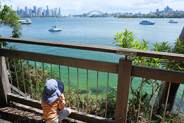
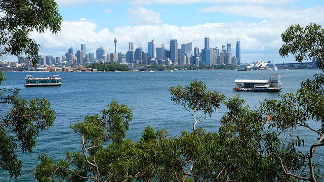
The walk around Bradleys Head treats you with amazing views of Sydney Harbour and the Opera House, then further to views of South Head, Rose Bay, Shark Island and Chowder Bay through a bright coastal forest.
The best starting point is the Taronga Zoo wharf, which is very convenient if you come from the city center. The ferry from Circular Quay to Taronga Zoo takes about 12 minutes, and it’s a very scenic ride. In case you arrive by car, you find parking near Taronga Zoo. But the ideal start and end point of this loop trail is the Taronga Zoo wharf – which has fabulous views of Sydney Harbour.
Then you start the path around the headland. It runs in a beautiful forest, but you get views often enough. Take the short detour through the stairs to Athol Bay. It’s a quiet little beach that faces the Harbour Bridge and the Opera House. In fact, it’s so tiny that the sand almost fully disappears at high tide.
The walk to Bradleys Head Lighthouse will reward you with more views of the Sydney Harbour. Then you continue on the other side of the headland, and the trail becomes the Taylors Bay track, winding along the foreshore and offering views of Sydney Harbour National Park.
don’t let the pram in this picture mislead you: this is not a pram-friendly walk as I learned it from my own mistake – lots of stairs along the way!
You can’t really access Taylor’s Bay, nor there’s any point. There’s no beach here, it’s a small harbor. But you’ll enjoy views over it, before you find yourself in the forest again, crossing Chowder Head.
Finally, the trail opens up to the Clifton Gardens Reserve and Chowder Bay. This is a lovely, sheltered bay and one of the best family-friendly beaches in Sydney. One side of the bay is protected by a shark net, the water is usually calm and the waves are gentle. Clifton Gardens Reserve also has a large grassy area with picnic tables and benches, washroom blocks and a huge playground.
Clifton Gardens Reserve is your turning point. You partly walk the same way you came, but you can cross Bradleys Head instead of walking all around it again.
If you’re looking for a shorter trail, then this 3 km loop around Bradleys Head is very satisfying.
| Essential info: |
|---|
| Length: 6.9 km loop |
| Difficulty: easy |
| Pram-friendly? no |
| See the Bradley’s Head to Chowder Bay walk on a map here. |
Dee Why Beach to Manly Walk, Northern Beaches
The Dee Why Beach to Manly Walk combines some of the best beach walks with sweeping ocean views from the headlands in between. You’ll pass five beaches on the way: Dee Why Beach, Curl Curl Beach, Freshwater Beach, Queenscliff Beach and Manly Beach.
The walk starts from the Dee Why rock pools at the southern end of the beach. A narrow, dirt trail takes you through Dee Why Headland, offering magnificent views of the rolling waves, first at Dee Why Beach, then at Curl Curl Beach.
You’ll descend to Curl Curl Beach. Here you can choose to walk on the paved promenade behind the beach, or on Curl Curl Beach in the sand. I love long beach walks, with the waves crashing at my feet, but if I don’t wish to be barefoot during winter time, walking on a hard surface is more convenient.
At the southern end of Curl Curl Beach a boardwalk takes you around the headland. Soon you’ll enjoy the view over Freshwater Beach in the next bay. Again, you can walk on the beach or behind it, depending on whether you’d like to walk in the sand or not.
As you leave Freshwater Beach, the trail leads through residential streets, there’s no walking trail around Queenscliff Head. A few steep streets and staircases later you’ll find yourself on the flat, paved oceanfront promenade that runs behind Queenscliff Beach and Manly Beach. This is a long bay, so walk as far as you like, then walk back the same way (or take public transport).
| Essential info: |
|---|
| Length: 6.5 km one-way |
| Difficulty: easy |
| Pram-friendly? no |
| See the Dee Why to Manly walk on a map here. |
Maroubra to Coogee Walk
Here’s the sister of the famous Bondi to Coogee Walk: the walk from Maroubra Beach to Coogee Beach. Actually, it’s an extension, and you can combine them into a ~12 km coastal walk (one-way). Ever since I’ve done this walk I wonder why it’s only a section of this beautiful route which is so famous. Because it’s very scenic all the way, from Bondi to Maroubra.
But then, I didn’t walk it all at once either. The rock pools, beaches, cafés and parks along the way invite you to enjoy a laid-back beach lifestyle, and who could resist? Definitely bring swimwear for this walk in the summer.
You can start it at either Coogee Beach or Maroubra Beach. My preference is Maroubra, but only because parking is easier there.
Maroubra Beach is a long, beautiful, golden sand beach, which is not very protected and can get quite rough. As you climb the stairs at the northern end of the beach, don’t forget to look back to the rolling waves. Then you’ll continue on the top of the cliffs – feel free to (carefully) wander around, marveling at the giant waves crashing the rocks.
You won’t pass another beach until Coogee Beach at the end, but you’ll find picturesque rocky coves and rock pools. Mahon Pool is in the midst of a wide rock platform, and there are two smaller ones further away, Rob Walker Rock Pool and Ivo Rowe Rock Pool.
The coastal homes look romantic, perched on the top of the dramatic cliffs. At one point you need to walk on the streets, because there’s no path on the coast. But then you return to the coastal walkway and boardwalk, finally descending to Coogee Beach.
| Essential info: |
|---|
| Length: 4.8 km one-way |
| Difficulty: easy |
| Pram-friendly? no |
| See the Maroubra to Coogee walk on a map here. |
Best nature walks in Sydney
Though you never seem to be out of coastal trails in Sydney, it isn’t only coastal trails that you can find. In this section I collected my favorite nature trails that don’t involve ocean vistas, but lots of them are (not surprisingly) near some form of water.
Narrabeen Lagoon Trail, Northern Beaches
Narrabeen Lagoon is actually the ocean, but it’s a big, sheltered lagoon that gives a feeling of a lake. An easy walking path runs around it, partly paved and partly gravel, and almost completely flat. You can enjoy the closeness of nature while being not far from restaurants and cafés. Nice benches and picnic areas can be found along the way if you’d prefer bringing your own food.
You can access this loop trail almost anywhere from the nearby streets, and it’s a great, family-friendly walk on any sunny day, even if you don’t do the full loop.
| Essential info: |
|---|
| Length: 8.8 km loop |
| Difficulty: easy |
| Pram-friendly? yes |
| See the Narrabeen Lagoon loop on a map here. |
Lane Cove Riverside Circuit, Lane Cove National Park
The Riverside Circuit in Lane Cove National Park is one of the best bush walks in Sydney, and another trail that we regularly visit. Though I’ve never hiked it from beginning to end, I walked several different sections of the 10 km loop.
It’s a scenic bush walk, meandering along Lane Cove River which eventually flows into Sydney Harbour. The river is peaceful, you find lots of picnic areas and meadows on the way, and it’s a great place for birdwatching – lots of lorikeets, kookaburras, egrets, spoonbills. (Just watch out for hungry Kookaburras, because they like stealing the food out of your hand. It happened to us, and not once.)
You can start this loop from lots of locations along the way, like Koonjeree Picnic Area, Carter Creek or Cottonwood Glen Picnic Area. They are all on the western side where the road runs closer to the trail, and there are lots of access points. But you can access the eastern side of the river, too. The most straightforward access point is Jenkins Hill Picnic Area at the southern end of the eastside trail.
This ~10 km loop is actually a combination of the Riverside Walking Track (on the western side) and a small portion of the Great North Walk (on the eastern side). The Riverside Walking Track is the easier of the two, but there’s only about 300 m elevation gain altogether which is not much for 10 km.
| Essential info: |
|---|
| Length: 10 km loop |
| Difficulty: easy |
| Pram-friendly? no |
| See the Lane Cove Riverside trail on a map here. |
Lake Parramatta Circuit
Lake Parramatta is a man-made reservoir, surrounded by dense bushland, with red gum trees and banksias. The lake has a swimming area which is popular in summer, and you can rent pedal boats or kayaks to explore the lake.
There’s a ~4 km loop trail around Lake Parramatta, meandering on the lakeshore and mostly under the trees. The banks of the reservoir are quite steep, and the uneven path takes you up and down as it circles it, crossing a creek twice on the way. You’ll enjoy views from several elevated natural viewpoints.
It’s an easy hiking trail, but a hiking trail nevertheless: not pram-friendly, not flat and not even. The terrain and the length makes it ideal for family hikes though, even with small kids. I completed it with my 3.5-year-old first.
You find free barbecues and a playground by the main parking lot.
| Essential info: |
|---|
| Length: 4.3 km loop |
| Difficulty: easy |
| Pram-friendly? no |
| See the Lake Parramatta Circuit on a map here. |
Best hikes around Sydney
If the hikes and walks inside the city are not enough, you don’t need to go far for much more. While it could be a topic of another lengthy post to list all the best hikes near Sydney (and it will be), here’s a short summary with one of my favorite hikes from every park nearby.
Tired of endless searching for kid-friendly Sydney walks?
Stop the guesswork! My Sydney’s Best Family Walks ebook gives you 50 kid-tested trails with all the details you need: maps, parking, difficulty, pram access, and unique “Play Factor” notes. Plus, get 130+ bonus nature play ideas & printables!
Unlock stress-free family adventures.
Bundeena to Little Marley Beach, Royal National Park
Royal National Park is home to some of the most scenic coastal trails in the world. Actually “the Coast Track” is a contiguous trail that’s 26 km one-way. You can do it as a multi-day track, camping at North Era Beach to break it up. But since several points of the trail are accessible by car, you can choose to explore it on several day hikes, as well. That’s what we did.
Each of the sections are among the best day hikes in Sydney, so it’s hard to pick a favorite. But here’s my pick: the trail from Bundeena to Little Marley Beach, the first section of the Coast Track from the north. It runs directly along the coast, following the cliff edge, and offers incredible views of the ocean and the coastal rock formations.
The most famous rock formation is Wedding Cake Rock, an unusual white limestone cliff edge, surrounded by yellow sandstone, which resembles a slice of wedding cake. It’s fenced off, because it’s unstable and can tumble into the water any time, so you can’t stand on it. It has been closed for years.
You can turn back from Wedding Cake Rock, but I recommend not to. The rest of the track has fantastic views of the rugged coastline, the best ones are from Marley Head. Then you arrive at Big Marley Beach.
Strolling this long, wild, sandy bay is romantic enough, but then the walk on the headland to Little Marley Beach is another very scenic section of the hike. Little Marley Beach is similarly pretty as its sister, but neither of them are usually safe for swimming due to the strong currents and powerful waves.
The hike from Bundeena to Little Marley Beach is not flat, but has very little elevation gain. It runs on a boardwalk for most of the way, with some uneven sections on the top of the cliffs. The effort-reward ratio is exceptional.
You’ll have a chance to spot migrating whales in the water between May and October all along the Coast Track. Chances are the best at the end of June and at the beginning of September.
| Essential info: |
|---|
| Length: 5.3 km one-way |
| Difficulty: easy |
| Pram-friendly? no |
| See the Bundeena to Little Marley Beach walk on a map here. |
Cape Baily Track, Kamay Botany Bay National Park
The easiest and most beautiful coastal walk in Kamay Botany Bay National Park is the one from Cape Solander Lookout to Cape Baily Lighthouse. It runs on the top of the cliffs, right along the edge, so you’ll enjoy fabulous coastal views. Actually, the landscape and the scenery reminded us very much of the Coast Track in Royal National Park.
It’s an easy track, with little elevation change and lots of boardwalked sections. The best time to hike here is winter, not only because of the whale-watching opportunities, but also because it’s an unshaded trail which gets very hot during the long summer months.
The turnaround point for this hike is Cape Baily Lighthouse. The short detour from the coastal track to the lighthouse is a bit steep. You can catch a glimpse of the (distant) Sydney skyline, but otherwise it’s not a particularly pretty lighthouse. It’s still an active one though, helping north-bound ships navigate the coast.
You can turn back from Cape Baily and return the same way. Optionally, you can walk all the way to Cronulla if you continue on the coastal path.
| Essential info: |
|---|
| Length: 3.3 km one-way |
| Difficulty: easy |
| Pram-friendly? no |
| See the Cape Baily walk on a map here. |
Resolute Beach Circuit Walk, Ku-ring-gai Chase National Park
Ku-ring-gai Chase National Park is one of the closest parks to our home, so we visit it very often. This makes it hard enough to choose a favorite trail, because we found lots of known and not really known trails with incredible views in this park. Not to mention the shy wallabies you can bump into.
But here’s a combination of trails that won’t disappoint: the loop via Resolute Track, Headland Track and Koolewong Track. It’s in the West Head section of the park, opposite the Barrenjoey Headland, and it delivers a few exceptional views of Pittwater and Broken Bay, and access to two secluded, beautiful beaches: West Head Beach and Resolute Beach. They’re among the most protected wild beaches in Sydney, and they’re excellent for swimming in the summer.
You start this track at the West Head Lookout, which offers views of Barrenjoey Headland and Broken Bay. It continues in a pretty coastal forest where you catch glimpses of the incredible color of the water among the trees. Keep your eyes open for a narrow detour not long after you start the hike. It leads to a rocky platform and treats you with a nice view of Pittwater.
The coastal path is shady, quite narrow and a bit steep at places. Don’t do it in flip-flops, you need proper hiking shoes. The access to both beaches are via steep staircases. Resolute Beach is the most beautiful, it’s among the very best beaches in Sydney (which is really something, because Sydney has no shortage of pretty beaches).
On your way back take the Headland Track which climbs up in the forest, further from the coast. Don’t forget to look back, because you’ll have some nice views as you ascend above the trees. Then you’ll reach a parking lot along West Head Road. From here a hiking trail runs parallel to the road, and it takes you back to West Head Lookout.
But I recommend extending your loop with the Koolewong Track. It’s a short trail through a very picturesque part of the forest, with twisted eucalyptus trees and cabbage palms, ending at an amazing lookout.
| Essential info: |
|---|
| Length: 4.8 km loop |
| Difficulty: medium |
| Pram-friendly? no |
| See the Resolute Beach circuit walk on a map here. |
Grand Canyon, Blue Mountains
The Grand Canyon Walk is one of our favorite walking tracks in the Blue Mountains. The canyon itself is spectacular, but it’s not only that. The lush rainforest, the small creeks and waterfalls, the large rock overhangs – they give this hike a magical vibe.
It’s not a difficult hike, nor a very long one, but it has a very steep descent and ascent as you start and finish the loop (you need to descend into the canyon, then climb up at the end). As you enter the canyon, the temperatures get much cooler, so it’s a pleasant hike even during the warmer summer months.
It’s a loop, and you can start it at several places. The most convenient is the Grand Canyon car park which was built for hikers and offers over 100 parking bays. Evans Lookout also has a car park, though much smaller.
From Evans Lookout the Grand Canyon track descends into the canyon and runs along Greaves Creek. You need to cross it several times, but there are stepping stones. Fern and moss covers the high sandstone rock walls, and the creek flows through the canyon, the trail following along. There’s no dedicated viewpoint or highlight down in the canyon, but the walk through it is very beautiful all the way.
At the end you need to climb out of the canyon. It’s steep, and a lot of stairs are involved, but it’s still a delightful, scenic forest trail. You’ll feel the air heat up around you, becoming more dry with each step up.
Make sure you have enough water for the full loop. A good pair of hiking boots is also recommended, some parts of the trail are slippery and muddy.
| Essential info: |
|---|
| Length: 6 km loop |
| Difficulty: medium |
| Pram-friendly? no |
| See the Grand Canyon walk on a map here. |
Bullimah Spur Track, Bouddi National Park
view of Maitland Bay
Bullimah Spur Track is such a short and delightful hiking trail on the Central Coast. It leads you through scenic bushland, offering several rocky outcrops with stunning views on the way. The highlight is the rock platform at the end though, with views over both Maitland Bay, Broken Bay and Putty Beach.
The trailhead is at the Maitland Bay Information Centre, and you’ll head down the trail towards Maitland Bay. Watch out for the Bullimah Spur Junction though, it’s after a few hundred meters and signposted.
view of Putty Beach
The path meanders through a pretty gum tree forest. It’s relatively easy, but has some elevation gain, uneven surface and the occasional rock scrambling. Keep your eyes open for sandstone outcrops left of the walking path, this is your first natural viewpoint. The lookout at the end is also a natural rocky plateau, great for a scenic picnic before you take the same way back.
We love this trail in any season. Sunny winter days are very pleasant for hiking, and this short trail can be done early in the morning or late in the afternoon on hot summer days. You find several amazing beaches in the area, so you can combine visiting them with hiking the Bullimah Spur Track.
| Essential info: |
|---|
| Length: 2.4 km return |
| Difficulty: easy |
| Pram-friendly? no |
| See the Bullimah Spur Track on a map here. |
Somersby Falls, Brisbane Water National Park
This is a lovely, short waterfall walk on the Central Coast, a favorite of local families and one that could be a great stop on your drive from Sydney to Brisbane.
The trail starts from Somersby Falls picnic area and runs to the bottom of Somersby Falls. Really, it’s only a few hundred meters, but it’s a hiking track, with long stairs and steep, uneven terrain. But quicker than you think you’ll stand at the bottom of Somersby Falls, refreshing yourself in the cool spray.
This short walk is great for spotting birds, water dragons, frogs and goannas. The waterfall is particularly pretty after heavy rains.
The Somersby Falls picnic area has been reopened in June 2024, after extensive reconstruction work, awaiting with brand new facilities and a safer walking path.
| Essential info: |
|---|
| Length: 0.5 km return |
| Difficulty: easy |
| Pram-friendly? no |
| See the Somersby Falls Track on a map here. |
Want amazing Sydney family walks without the planning headache?
My ebook features 50 detailed, kid-approved trails with maps, parking, pram info & fun “Play Factor” highlights. PLUS: 130+ nature play ideas & printables to get your family outdoors!
Spend less time searching, more time exploring. Get your instant download!
My favorite gear for coastal walks
After countless bushwalks and coastal rambles, here’s what I usually have for sensible comfort and peace of mind for those adventures that can easily end in a coffee shop (strictly before 3pm, otherwise you’d find them closed).
Footwear
- Proper hiking shoes with good grip, like the Columbia Newton Ridge Plus, both for women and men – Essential for rocky patches, slippery steps, and those unexpected mud puddles that mysteriously appear even after a dry spell. Don’t twist your ankle in flip-flops, most of these walks are not strolls on a paved promenade.
- Water shoes or reef shoes – If your hike ends at a beach or rock pool, these are a godsend to explore the rock at low tide.
Sun & insect protection
- Wide‑brimmed, adjustable sun hat (and this is my favorite for kids) – The Aussie sun is fierce even in winter. A hat with a chin strap means it won’t fly off when the coastal breezes decide to make an appearance.
- Reef‑safe sunscreen (high SPF) – Protects your skin and the beautiful marine life if you end up swimming. A good habit for every outdoor day.
- Insect repellent bands – For those lush, shaded bush sections or twilight walks.
Hydration & the fuel for fun
- Durable reusable water bottles (preferably metal to avoid microplastic) – Always carry more water than you think you’ll need.
- Electrolyte‑boosted drinks and energy bars – For those moments when the kids (or you) declare “I can’t possibly take another step!”
- Compact picnic blanket – For impromptu breaks, lunch with a view, or simply sitting on damp ground without getting a soggy bottom.
Safety & navigation (just in case)
- Compact first‑aid kit – Small scrapes, unexpected blisters, or a sudden spider bite (rare, but good to be prepared). Ours always has band‑aids, antiseptic wipes, and anti‑itch cream.
- Compact headlamp or small torch – For unexpected detours, chasing sunset views, or those bathroom visits at dusk.
- Printed map or reliable offline map app on your phone – Phone reception can be patchy in national parks. Don’t trust Google Maps blindly.
For the little explorers
- Child‑friendly binoculars – Turn any view into a treasure hunt for birds or distant boats.
- Small backpack for kids (with snacks inside) – They love carrying their own gear (if they don’t, they need to get used to it, anyway), and it gives them a sense of purpose.







Leave a Reply